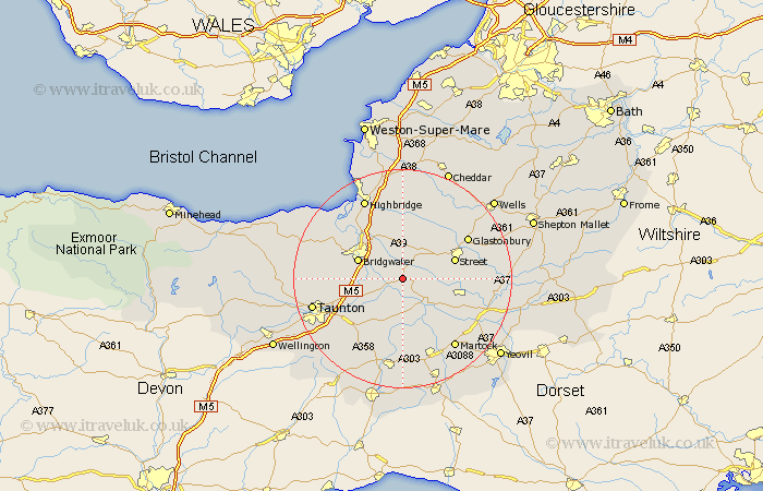
Somerset Map Showing Location of Othery
Population: 575
District: Sedgemoor
Easting: 338134 Northing: 131983
Latitude: 51.08 Longitude: -2.88
 = Othery
District: Sedgemoor
Easting: 338134 Northing: 131983
Latitude: 51.08 Longitude: -2.88
= Othery
This Othery map below is supplied by Google. Use the tools in the top left corner to zoom into street level or zoom out for a road map, you may also need to zoom in to see Othery on the map. Click and drag the map to move around. If the map fails to load try and refresh your browser or zoom in or out (+ or -).
Update - it seems Google no longer allow people to use their maps for free! This Othery map sometimes loads and sometimes gives a error. I am working on a solution.
Closest 30 Towns or Cities to Othery (Population over 500)
Middlezoy 2.19km High Ham 5.01km Weston Zoyland 5.1km Shapwick 6.57km Stoke Saint Gregory 6.57km Stoke St Gregory 6.57km Stoke St. Gregory 6.57km Langport 6.57km Curry Rivel 7.41km Cossington 7.77km Ashcott 8.05km Walton 8.95km Bridgewater 8.95km Bridgwater 8.95km North Curry 9.42km North Petherton 9.5km Fivehead 9.55km Street 10.02km Somerton 10.03km Puriton 10.95km Long Sutton 11.02km Meare 11.61km Compton 11.79km Creech St Michael 11.9km Creech Saint Michael 11.9km Creech St. Michael 11.9km Durleigh 12.22km West Monkton 12.22km Kingsbury Episcopi 12.55km Kingsbury 12.55km