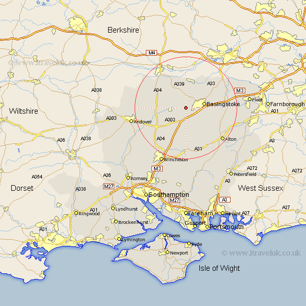
Hampshire Map Showing Location of Oakley
Population: 5707
Area Size (ha): 164
District: Basingstoke and Deane
Easting: 456991 Northing: 150465
Latitude: 51.25 Longitude: -1.18
 = Oakley
Area Size (ha): 164
District: Basingstoke and Deane
Easting: 456991 Northing: 150465
Latitude: 51.25 Longitude: -1.18
= Oakley
This Oakley map below is supplied by Google. Use the tools in the top left corner to zoom into street level or zoom out for a road map, you may also need to zoom in to see Oakley on the map. Click and drag the map to move around. If the map fails to load try and refresh your browser or zoom in or out (+ or -).
Update - it seems Google no longer allow people to use their maps for free! This Oakley map sometimes loads and sometimes gives a error. I am working on a solution.
Closest 30 Towns or Cities to Oakley (Population over 500)
Overton 5km North Waltham 5.56km Dummer 6.02km Basingstoke 7.2km Kingsclere 8.75km Baughurst 9.33km Basing 10.6km Ecchinswell 10.93km Bramley 10.99km Whitchurch 11.08km Tadley 11.65km Burghclere 11.87km Sherfield 12.86km Sherfield upon Loddon 12.86km Upton Grey 13.29km Silchester 13.76km Highclere 13.95km Micheldever 14.22km Wonston 14.49km Rotherwick 15.52km Barton Stacey 15.78km Hook 16.34km Longparish 16.82km Medstead 16.91km Odiham 17.4km Four Marks 17.49km Long Sutton 17.8km New Alresford 18.57km Hurstbourne Tarrant 18.65km Alton 19.04km