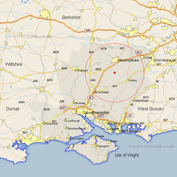
Hampshire Map Showing Location of Nutley
Population: 106
District: Basingstoke and Deane
Easting: 461731 Northing: 143103
Latitude: 51.18 Longitude: -1.12
 = Nutley
District: Basingstoke and Deane
Easting: 461731 Northing: 143103
Latitude: 51.18 Longitude: -1.12
= Nutley
This Nutley map below is supplied by Google. Use the tools in the top left corner to zoom into street level or zoom out for a road map, you may also need to zoom in to see Nutley on the map. Click and drag the map to move around. If the map fails to load try and refresh your browser or zoom in or out (+ or -).
Update - it seems Google no longer allow people to use their maps for free! This Nutley map sometimes loads and sometimes gives a error. I am working on a solution.
Closest 30 Towns or Cities to Nutley (Population over 500)
Dummer 2.97km North Waltham 5km Medstead 8.19km Four Marks 8.75km Oakley 8.75km Upton Grey 8.94km Basingstoke 9.56km Overton 10.82km Alton 10.83km Basing 10.94km New Alresford 11.65km Micheldever 11.85km Upper Farringdon 13.13km Faringdon 13.13km Farringdon 13.13km Ropley 13.17km Long Sutton 13.3km Froyle 14.07km Wonston 14.43km Sherfield upon Loddon 14.73km Sherfield 14.73km Odiham 14.77km Hook 14.86km Cheriton 15.23km Bramley 15.24km Rotherwick 15.26km Whitchurch 15.55km Bramdean 16.68km Binsted 16.69km Kings Worthy 16.95km