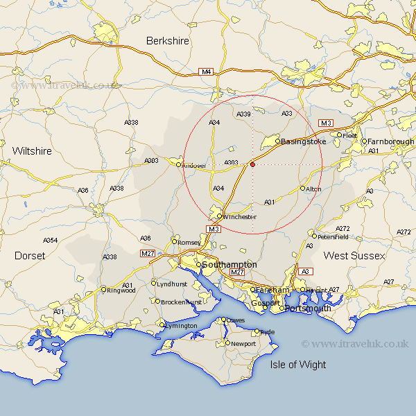
Hampshire Map Showing Location of North Waltham
Population: 840
District: Basingstoke and Deane
Easting: 457052 Northing: 144906
Latitude: 51.2 Longitude: -1.18
 = North Waltham
District: Basingstoke and Deane
Easting: 457052 Northing: 144906
Latitude: 51.2 Longitude: -1.18
= North Waltham
This North Waltham map below is supplied by Google. Use the tools in the top left corner to zoom into street level or zoom out for a road map, you may also need to zoom in to see North Waltham on the map. Click and drag the map to move around. If the map fails to load try and refresh your browser or zoom in or out (+ or -).
Update - it seems Google no longer allow people to use their maps for free! This North Waltham map sometimes loads and sometimes gives a error. I am working on a solution.
Closest 30 Towns or Cities to North Waltham (Population over 500)
Dummer 2.32km Oakley 5.56km Overton 5.94km Micheldever 9.42km Basingstoke 10.17km Whitchurch 10.61km Wonston 10.83km Medstead 12.33km Basing 12.81km Upton Grey 12.91km New Alresford 13.03km Four Marks 13.12km Barton Stacey 13.3km Kingsclere 13.78km Baughurst 14.87km Longparish 15.21km Bramley 15.31km Kings Worthy 15.32km Alton 15.79km Ecchinswell 15.92km Burghclere 15.95km Sherfield upon Loddon 16.07km Sherfield 16.07km Ropley 16.38km Cheriton 16.72km Tadley 17.04km Long Sutton 17.51km Rotherwick 17.7km Farringdon 17.84km Upper Farringdon 17.84km