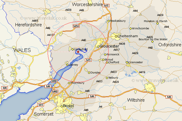
Gloucestershire Map Showing Location of Newnham
Population: 1285
District: Forest of Dean
Easting: 370122 Northing: 211400
Latitude: 51.8 Longitude: -2.43
 = Newnham
District: Forest of Dean
Easting: 370122 Northing: 211400
Latitude: 51.8 Longitude: -2.43
= Newnham
This Newnham map below is supplied by Google. Use the tools in the top left corner to zoom into street level or zoom out for a road map, you may also need to zoom in to see Newnham on the map. Click and drag the map to move around. If the map fails to load try and refresh your browser or zoom in or out (+ or -).
Update - it seems Google no longer allow people to use their maps for free! This Newnham map sometimes loads and sometimes gives a error. I am working on a solution.
Closest 30 Towns or Cities to Newnham (Population over 500)
Awre 3.7km Cinderford 3.91km Frampton on Severn 5.89km Frampton-on-Severn 5.89km Frampton 5.89km Drybrook 7.2km Longhope 7.5km Huntley 7.76km Mitcheldean 8.17km Milcheldean 8.17km Hardwicke 9.35km Slimbridge 9.88km Quedgeley 10.48km Bream 10.73km Coleford 11.46km Coaley 11.54km Lydney 11.54km Lydbrook 11.71km Stonehouse 11.72km Tibberton 12.51km Cam 12.51km Berkeley 13.03km Gloucester 13.13km Randwick 13.14km Newent 15km Staunton 15.01km Newland 15.02km North Nibley 15.22km Uley 15.26km Hartpury 15.88km