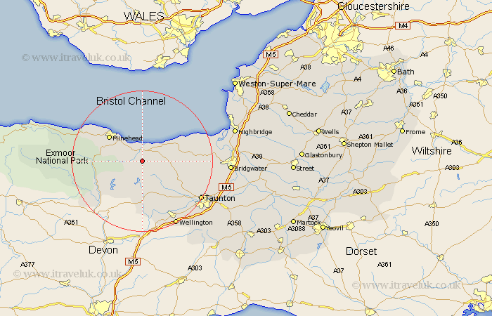
Somerset Map Showing Location of Nettlecombe
Population: 199
District: West Somerset
Easting: 305553 Northing: 138038
Latitude: 51.13 Longitude: -3.35
 = Nettlecombe
District: West Somerset
Easting: 305553 Northing: 138038
Latitude: 51.13 Longitude: -3.35
= Nettlecombe
This Nettlecombe map below is supplied by Google. Use the tools in the top left corner to zoom into street level or zoom out for a road map, you may also need to zoom in to see Nettlecombe on the map. Click and drag the map to move around. If the map fails to load try and refresh your browser or zoom in or out (+ or -).
Update - it seems Google no longer allow people to use their maps for free! This Nettlecombe map sometimes loads and sometimes gives a error. I am working on a solution.
Closest 30 Towns or Cities to Nettlecombe (Population over 500)
Williton 1.16km Stogumber 3.49km Watchet 3.89km Carhampton 7.25km Wiveliscombe 11.36km Minehead 11.89km Nether Stowey 12.92km Bishops Lydeard 13.79km Milverton 14.73km Stokscourey 16.1km Stogursey 16.1km Stoke Courcy 16.1km Spaxton 16.39km Oake 16.67km Dulverton 17.86km Norton Fitzwarren 17.86km Dunster 17.88km Kingston 17.9km Brushford 18.22km Otterhampton 19.41km Taunton 19.73km Wellington 20.74km Durleigh 21.02km West Buckland 21.88km Trull 22.03km West Monkton 22.91km Porlock 23.29km North Petherton 23.56km Bridgwater 24.5km Bridgewater 24.5km