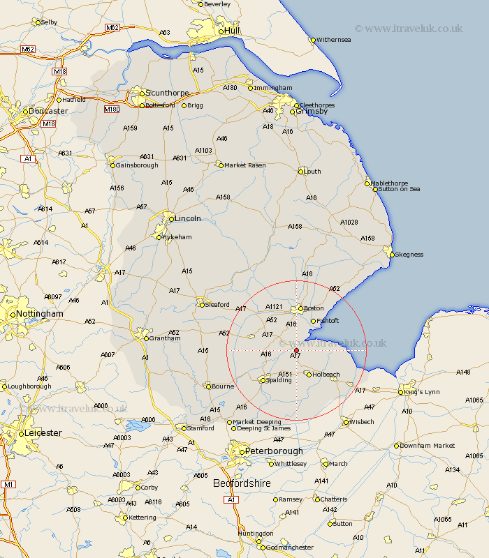
Lincolnshire Map Showing Location of Fosdyke
Population: 486
District: Boston
Easting: 532370 Northing: 331760
Latitude: 52.87 Longitude: -0.03
 = Fosdyke
District: Boston
Easting: 532370 Northing: 331760
Latitude: 52.87 Longitude: -0.03
= Fosdyke
This Fosdyke map below is supplied by Google. Use the tools in the top left corner to zoom into street level or zoom out for a road map, you may also need to zoom in to see Fosdyke on the map. Click and drag the map to move around. If the map fails to load try and refresh your browser or zoom in or out (+ or -).
Update - it seems Google no longer allow people to use their maps for free! This Fosdyke map sometimes loads and sometimes gives a error. I am working on a solution.
Closest 30 Towns or Cities to Fosdyke (Population over 500)
Sutterton 5km Kirton 5.67km Frampton 5.67km Wyberton 7.49km Surfleet 7.67km Weston 7.75km Gosberton 8.05km Holbeach 8.14km Quadring 8.95km Whaplode 9.27km Moulton 9.34km Fishtoft 10.29km Bicker 10.53km Swineshead 10.77km Pinchbeck 10.79km Fleet 11.45km Donington 11.78km Frieston 12.44km Freiston 12.44km Lutton 12.51km Spalding 12.89km Gedney 12.89km Boston 13.01km Brothertoft 13.71km Long Sutton 14.54km Butterwick 14.6km Bennington 15.14km Benington 15.14km Cowbit 15.86km Sutton St. James 16.28km