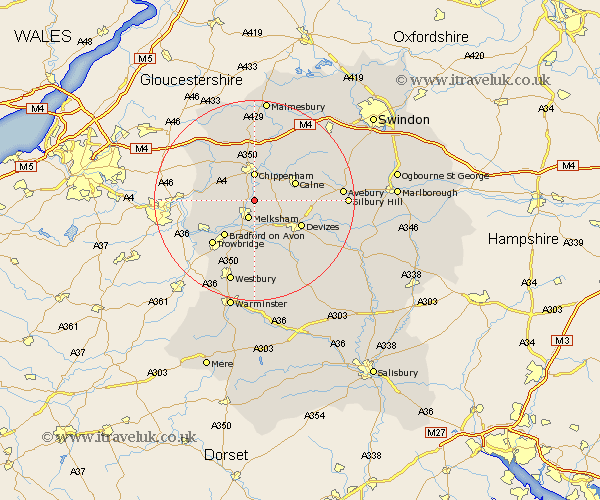
Wiltshire Map Showing Location of Lacock
Population: 1000
District: North Wiltshire
Easting: 391884 Northing: 166835
Latitude: 51.4 Longitude: -2.12
 = Lacock
District: North Wiltshire
Easting: 391884 Northing: 166835
Latitude: 51.4 Longitude: -2.12
= Lacock
This Lacock map below is supplied by Google. Use the tools in the top left corner to zoom into street level or zoom out for a road map, you may also need to zoom in to see Lacock on the map. Click and drag the map to move around. If the map fails to load try and refresh your browser or zoom in or out (+ or -).
Update - it seems Google no longer allow people to use their maps for free! This Lacock map sometimes loads and sometimes gives a error. I am working on a solution.
Closest 30 Towns or Cities to Lacock (Population over 500)
Melksham 3.88km Corsham 5.07km Chippenham 5.56km Broughton Gifford 5.93km Seend 6.02km Semington 6.02km Atworth 6.07km Whitley 6.15km Bremhill 8.02km Holt 8.02km Rowde 8.02km Calne 8.9km Bradford on Avon 9.41km Bradford-on-Avon 9.41km Box 9.43km Worton 9.89km Roundway 9.97km Hilperton 10.35km Devizes 10.8km Yatton Keynell 10.92km Colerne 11.04km Steeple Ashton 11.18km Sutton Benger 11.36km Potterne 11.58km Cherhill 11.71km Christian Malford 12.04km Bishops Cannings 12.14km Trowbridge 12.3km Hillmarton 12.77km Hilmarton 12.77km