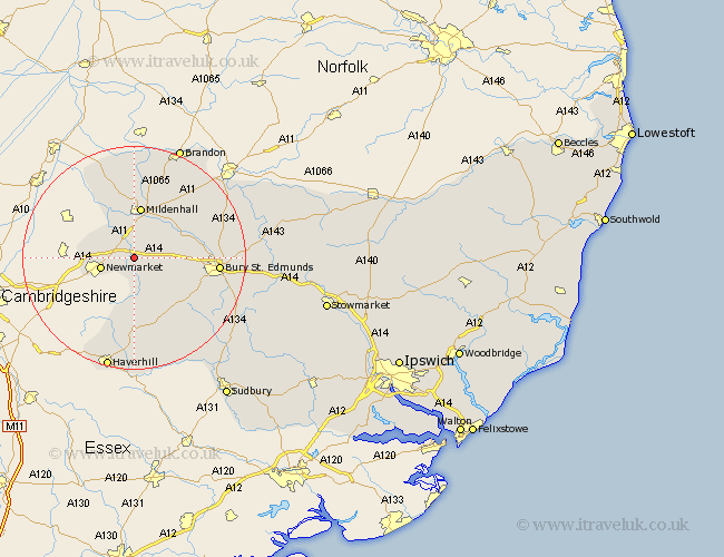
Suffolk Map Showing Location of Kentford
Population: 408
District: Forest Heath
Easting: 570574 Northing: 266158
Latitude: 52.27 Longitude: 0.5
 = Kentford
District: Forest Heath
Easting: 570574 Northing: 266158
Latitude: 52.27 Longitude: 0.5
= Kentford
This Kentford map below is supplied by Google. Use the tools in the top left corner to zoom into street level or zoom out for a road map, you may also need to zoom in to see Kentford on the map. Click and drag the map to move around. If the map fails to load try and refresh your browser or zoom in or out (+ or -).
Update - it seems Google no longer allow people to use their maps for free! This Kentford map sometimes loads and sometimes gives a error. I am working on a solution.
Closest 30 Towns or Cities to Kentford (Population over 500)
Moulton 2.18km Gazeley 2.18km Newmarket 5.97km Barrow 6.78km Risby 9.07km Mildenhall 9.33km Exning 10.21km Chevington 10.87km Eriswell 11.35km Chedburgh 12.21km Fornham All Saints 13.61km Wickhambrook 13.75km Bury St. Edmunds 14.86km Bury Saint Edmunds 14.86km Bury St Edmunds 14.86km Thurlow 17.62km Great Barton 18.15km Hundon 18.85km Rushbrooke 18.99km Lakenheath 19.07km Lake Heath 19.07km Barnham 19.37km Troston 20.06km Kedington 20.42km Lawshall 20.52km Haverhill 20.89km Clare 21.17km Thurston 21.63km Honington 21.7km Bradfield St. George 21.73km