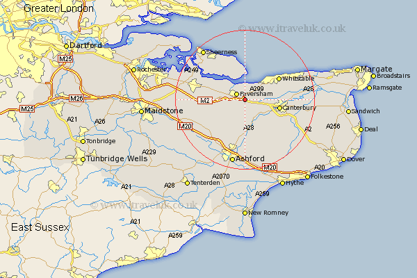
Kent Map Showing Location of Goodnestone
District: Swale
Easting: 604461 Northing: 159795
Latitude: 51.3 Longitude: 0.93
 = Goodnestone
Easting: 604461 Northing: 159795
Latitude: 51.3 Longitude: 0.93
= Goodnestone
This Goodnestone map below is supplied by Google. Use the tools in the top left corner to zoom into street level or zoom out for a road map, you may also need to zoom in to see Goodnestone on the map. Click and drag the map to move around. If the map fails to load try and refresh your browser or zoom in or out (+ or -).
Update - it seems Google no longer allow people to use their maps for free! This Goodnestone map sometimes loads and sometimes gives a error. I am working on a solution.
Closest 30 Towns or Cities to Goodnestone (Population over 500)
Faversham 2.97km Selling 3.88km Oare 3.94km Dunkirk 3.94km Ospringe 4.63km Harbledown 7.2km Chilham 7.77km Chartham 8.03km Blean 8.11km Teynham 8.91km Canterbury 10.07km Linsted 10.43km Lynsted 10.43km Hackington 10.59km Chestfield 10.81km Leysdown on Sea 11.18km Leysdown-on-Sea 11.18km Leysdown 11.18km Warden 11.36km Whitstable 11.52km Bapchild 11.73km Lower Hardres 11.88km Eastchurch 12.04km Doddington 12.17km Petham 12.32km Sturry 12.88km Wye 12.98km Sittingbourne 13.27km Charing 14.48km Bridge 14.75km