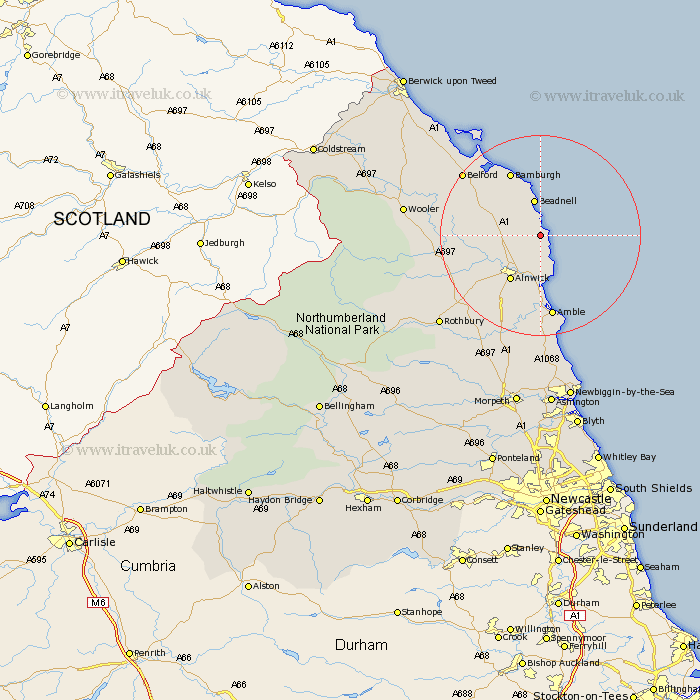
Northumberland Map Showing Location of Embleton
Population: 699
District: Alnwick
Easting: 424223 Northing: 621122
Latitude: 55.48 Longitude: -1.62
 = Embleton
District: Alnwick
Easting: 424223 Northing: 621122
Latitude: 55.48 Longitude: -1.62
= Embleton
This Embleton map below is supplied by Google. Use the tools in the top left corner to zoom into street level or zoom out for a road map, you may also need to zoom in to see Embleton on the map. Click and drag the map to move around. If the map fails to load try and refresh your browser or zoom in or out (+ or -).
Update - it seems Google no longer allow people to use their maps for free! This Embleton map sometimes loads and sometimes gives a error. I am working on a solution.
Closest 30 Towns or Cities to Embleton (Population over 500)
Beadnell 7.49km Alnmouth 9.32km North Sunderland 9.79km Alnwick 10.65km Almwick 10.65km Lisburg 11.12km Lesbury 11.12km Shilbottle 13.63km Warkworth 14.82km Amble 16.81km Belford 18.82km Swarland 21.67km East Chevington 22.34km East Thirston 22.63km Thirston 22.63km Felton 22.85km Longframlington 24.6km Wooler 24.77km Rothbury 25.75km Lowick 27.62km Longhorsley 29.37km Ellington 29.81km Lynemouth 30.41km Hebron 33.62km Ancroft 34.07km Newbiggin by the Sea 34.44km Newbiggin-by-the-Sea 34.44km Pegswood 35.22km Morpeth 35.46km Ashington 35.57km