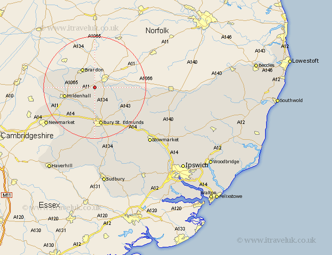
Suffolk Map Showing Location of Elveden
Population: 248
District: Forest Heath
Easting: 582600 Northing: 279571
Latitude: 52.38 Longitude: 0.68
 = Elveden
District: Forest Heath
Easting: 582600 Northing: 279571
Latitude: 52.38 Longitude: 0.68
= Elveden
This Elveden map below is supplied by Google. Use the tools in the top left corner to zoom into street level or zoom out for a road map, you may also need to zoom in to see Elveden on the map. Click and drag the map to move around. If the map fails to load try and refresh your browser or zoom in or out (+ or -).
Update - it seems Google no longer allow people to use their maps for free! This Elveden map sometimes loads and sometimes gives a error. I am working on a solution.
Closest 30 Towns or Cities to Elveden (Population over 500)
Barnham 3.86km Brandon 8.69km Lake Heath 9.67km Lakenheath 9.67km Honington 9.68km Troston 10.05km Eriswell 10.35km Mildenhall 11.91km Fornham All Saints 13.02km Risby 13.4km Bardwell 13.53km Ixworth 13.77km Great Barton 14.15km Bury St Edmunds 14.99km Bury St. Edmunds 14.99km Bury Saint Edmunds 14.99km Barningham 15.17km Stanton 16.47km Pakenham 16.49km Hepworth 16.79km Hopton 17.07km Thurston 17.37km Barrow 18.01km Gazeley 18.66km Norton 19.36km Badwell Ash 19.37km Rushbrooke 19.37km Moulton 20.11km Chevington 20.88km Redgrave 21.58km