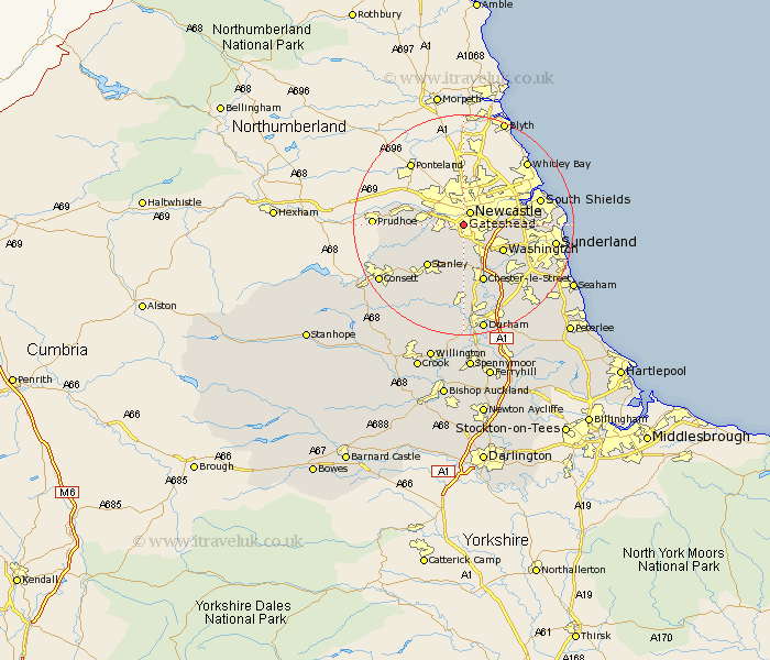
Durham Map Showing Location of Gateshead
Population: 82627
Area Size (ha): 2155
District: Gateshead
Easting: 424498 Northing: 561224
Latitude: 54.94 Longitude: -1.62
 = Gateshead
Area Size (ha): 2155
District: Gateshead
Easting: 424498 Northing: 561224
Latitude: 54.94 Longitude: -1.62
= Gateshead
This Gateshead map below is supplied by Google. Use the tools in the top left corner to zoom into street level or zoom out for a road map, you may also need to zoom in to see Gateshead on the map. Click and drag the map to move around. If the map fails to load try and refresh your browser or zoom in or out (+ or -).
Update - it seems Google no longer allow people to use their maps for free! This Gateshead map sometimes loads and sometimes gives a error. I am working on a solution.
Closest 30 Towns or Cities to Gateshead (Population over 500)
Lamesley 3.34km Felling 3.84km Whickham 4.4km Blaydon 5.79km Ouston Moor 6.24km Ouston 6.24km Hebburn on Tyne 6.88km Hebburn-on-Tyne 6.88km Hebburn 6.88km Birtley 7.59km Rowlands Gill 8.04km Burnopfield 8.07km Washington 8.16km Washington New Town 8.16km Pelton 8.78km Boldon 9.65km West Boldon 9.65km Stanley 9.87km Edmondsley 10.61km Chester-le-Street 11.05km Jarrow-on-Tyne 11.35km Jarrow on Tyne 11.35km Jarrow 11.35km Annfield Plain 12.9km Sacriston 14.27km Houghton le Spring 14.3km Leadgate 14.56km Sunderland 15.41km Whitburn 15.92km Lanchester 16.08km