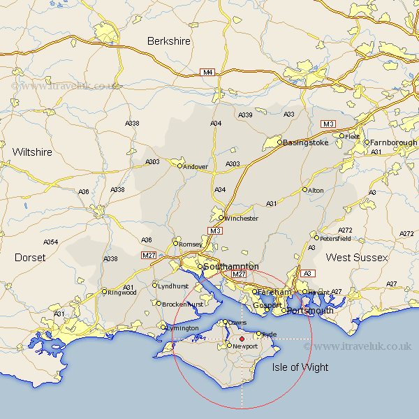
Hampshire Map Showing Location of Wootton
Population: 4250
Area Size (ha): 206
Easting: 454118 Northing: 91129
Latitude: 50.72 Longitude: -1.23
 = Wootton
Area Size (ha): 206
Easting: 454118 Northing: 91129
Latitude: 50.72 Longitude: -1.23
= Wootton
This Wootton map below is supplied by Google. Use the tools in the top left corner to zoom into street level or zoom out for a road map, you may also need to zoom in to see Wootton on the map. Click and drag the map to move around. If the map fails to load try and refresh your browser or zoom in or out (+ or -).
Update - it seems Google no longer allow people to use their maps for free! This Wootton map sometimes loads and sometimes gives a error. I am working on a solution.
Closest 30 Towns or Cities to Wootton (Population over 500)
Newport 3.98km Ryde 5.04km Arreton 5.68km East Cowes 5.98km Newchurch 6.03km Northwood 6.15km Gurnard 6.94km Brading 6.95km Cowes 7.27km Rookley 8.21km St. Helens 8.42km St Helens 8.42km Saint Helens 8.42km Seaview 9.39km Sandown 9.46km Lee-on-the-Solent 9.55km Lee-on-Solent 9.55km Lee on the Solent 9.55km Lee on Solent 9.55km Godshill 11.18km Bembridge 11.2km Gosport 11.63km Shanklin 11.66km Shalfleet 11.88km Shorwell 12.39km Calbourne 12.99km Wroxall 13.03km Jentnor 13.45km Ventnor 13.45km Fawley 13.82km