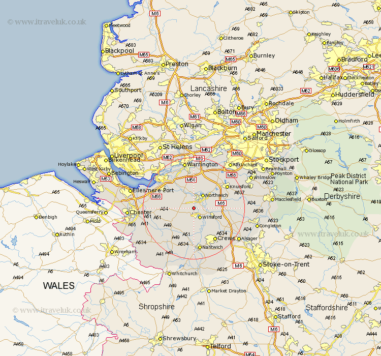
Cheshire Map Showing Location of Whitegate
Population: 971
District: Vale Royal
Easting: 363278 Northing: 369021
Latitude: 53.22 Longitude: -2.55
 = Whitegate
District: Vale Royal
Easting: 363278 Northing: 369021
Latitude: 53.22 Longitude: -2.55
= Whitegate
This Whitegate map below is supplied by Google. Use the tools in the top left corner to zoom into street level or zoom out for a road map, you may also need to zoom in to see Whitegate on the map. Click and drag the map to move around. If the map fails to load try and refresh your browser or zoom in or out (+ or -).
Update - it seems Google no longer allow people to use their maps for free! This Whitegate map sometimes loads and sometimes gives a error. I am working on a solution.
Closest 30 Towns or Cities to Whitegate (Population over 500)
Hartford 1.85km Davenham 2.89km Cuddington 3.81km Weaverham 4.32km Winsford 4.33km Little Budworth 4.99km Anderton 5.67km Marston 6.48km Northwich 6.48km Northwick 6.48km Acton 6.48km Delamere 7.77km Lostock Gralam 7.85km Middlewich 8.61km Middlewick 8.61km Kelsall 8.88km Kelsall Hill 8.88km Kelshall Hill 8.88km Kingsley 9.55km Plumley Station 10.47km Plumbley 10.47km Tarporley 10.74km Ashton 12.21km Holmes Chapel 12.35km Preston-on-the-Hill 12.96km Preston on the Hill 12.96km Preston Brook 12.96km Bunbury 12.96km Stretton 13.01km Peover Superior 13.82km