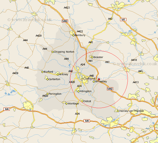
Oxfordshire Map Showing Location of Waterperry
Population: 170
District: South Oxfordshire
Easting: 463273 Northing: 206148
Latitude: 51.75 Longitude: -1.08
 = Waterperry
District: South Oxfordshire
Easting: 463273 Northing: 206148
Latitude: 51.75 Longitude: -1.08
= Waterperry
This Waterperry map below is supplied by Google. Use the tools in the top left corner to zoom into street level or zoom out for a road map, you may also need to zoom in to see Waterperry on the map. Click and drag the map to move around. If the map fails to load try and refresh your browser or zoom in or out (+ or -).
Update - it seems Google no longer allow people to use their maps for free! This Waterperry map sometimes loads and sometimes gives a error. I am working on a solution.
Closest 30 Towns or Cities to Waterperry (Population over 500)
Tiddington 2.18km Great Milton 3.7km Milton 3.7km Wheatley 3.91km Cuddesdon 5.06km Great Haseley 5.68km Thame 6.88km Garsington 7.21km Beckley 7.81km Tetsworth 7.99km Stadhampton 9.88km Littlemore 9.9km Chalgrove 11.12km Ambrosden 11.35km Oxford 11.47km Drayton St. Leonard 11.64km Drayton 11.64km Drayton Saint Leonard 11.64km Drayton St Leonard 11.64km Lewknor 12.26km Islip 12.71km Radley 12.72km Aston Rowant 13.05km Benson 13.17km Clifton Hampden 13.72km North Hinksey 13.9km Watlington 14.19km Dorchester 14.19km Chinnor 14.65km Launton 15km