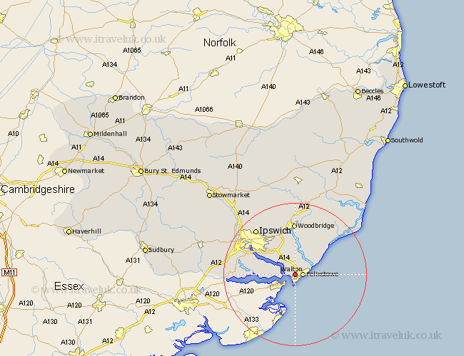
Suffolk Map Showing Location of Walton
Population: 19039
District: Suffolk Coastal
Easting: 630096 Northing: 235151
Latitude: 51.97 Longitude: 1.32
 = Walton
District: Suffolk Coastal
Easting: 630096 Northing: 235151
Latitude: 51.97 Longitude: 1.32
= Walton
This Walton map below is supplied by Google. Use the tools in the top left corner to zoom into street level or zoom out for a road map, you may also need to zoom in to see Walton on the map. Click and drag the map to move around. If the map fails to load try and refresh your browser or zoom in or out (+ or -).
Update - it seems Google no longer allow people to use their maps for free! This Walton map sometimes loads and sometimes gives a error. I am working on a solution.
Closest 30 Towns or Cities to Walton (Population over 500)
Felixstowe 2.06km Kirkton 3.71km Kirton 3.71km Shotley 4.8km Chelmondiston 7.31km Nacton 8.13km Bucklesham 8.82km Holbrook 10.66km Sutton 11.31km Martlesham Heath 11.4km Stutton 11.65km Hollesley 12.08km Martlesham 13.04km Melton 14.82km Woodbridge 14.82km Grundisburgh 15.58km Bentley 16.32km Ipswich 16.68km Ufford 16.8km Manningtree 17.46km Witnesham 17.52km Wirnesham 17.52km Sproughton 17.68km Sprughton 17.68km Capel 17.74km Capel St. Mary 17.74km Capel Saint Mary 17.74km Capel St Mary 17.74km Rendlesham 17.94km Bramford 18.72km