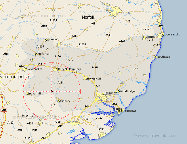
Suffolk Map Showing Location of Glemsford
Population: 3186
Area Size (ha): 71
District: Babergh
Easting: 582626 Northing: 248029
Latitude: 52.1 Longitude: 0.67
 = Glemsford
Area Size (ha): 71
District: Babergh
Easting: 582626 Northing: 248029
Latitude: 52.1 Longitude: 0.67
= Glemsford
This Glemsford map below is supplied by Google. Use the tools in the top left corner to zoom into street level or zoom out for a road map, you may also need to zoom in to see Glemsford on the map. Click and drag the map to move around. If the map fails to load try and refresh your browser or zoom in or out (+ or -).
Update - it seems Google no longer allow people to use their maps for free! This Glemsford map sometimes loads and sometimes gives a error. I am working on a solution.
Closest 30 Towns or Cities to Glemsford (Population over 500)
Cavendish 2.94km Long Melford 5.04km Clare 5.99km Lawshall 7.18km Hundon 7.97km Sudbury 8.7km Great Waldingfield 8.79km Waldingfield 8.79km Wickhambrook 8.8km Lavenham 9.11km Cockfield 9.71km Chedburgh 9.87km Great Cornard 10.09km Chevington 11.63km Kedington 12.66km Bradfield St George 14.37km Bradfield St. George 14.37km Bradfield Saint George 14.37km Bradfield 14.37km Rushbrooke 14.66km Barrow 15.87km Hitcham 16.04km Haverhill 16.05km Boxford 16.52km Bury St. Edmunds 17.02km Bury St Edmunds 17.02km Bury Saint Edmunds 17.02km Bildeston 17.08km Thurlow 17.17km Rattlesden 17.45km