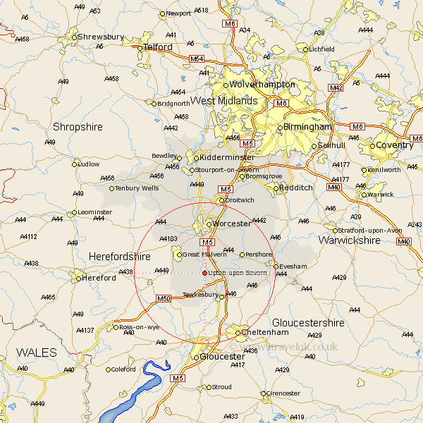
Worcestershire Map Showing Location of Upton
Population: 1722
Area Size (ha): 45
District: Malvern Hills
Easting: 385149 Northing: 240993
Latitude: 52.07 Longitude: -2.22
 = Upton
Area Size (ha): 45
District: Malvern Hills
Easting: 385149 Northing: 240993
Latitude: 52.07 Longitude: -2.22
= Upton
This Upton map below is supplied by Google. Use the tools in the top left corner to zoom into street level or zoom out for a road map, you may also need to zoom in to see Upton on the map. Click and drag the map to move around. If the map fails to load try and refresh your browser or zoom in or out (+ or -).
Update - it seems Google no longer allow people to use their maps for free! This Upton map sometimes loads and sometimes gives a error. I am working on a solution.
Closest 30 Towns or Cities to Upton (Population over 500)
Hanley Castle 2.17km Seven Stoke 3.7km Severn Stoke 3.7km Ripple 4.36km Welland 5.99km Castlemorton 6.8km Eckington 6.84km Defford 7.08km Wadborough 7.19km Kempsey 7.49km Bredon 7.78km Malvern Wells 8.19km Great Malvern 8.81km Malvern 8.81km Eldersfield 10.89km Powick 11.35km Pershore 11.66km Peopleton 12.22km Beckford 13.72km Leigh 14.65km Fladbury 14.75km Worcester 14.87km Cropthorne 14.92km Ashton-under-Hill 15.27km Ashton under Hill 15.27km Crowle 16.32km Charlton 16.37km Hallow 16.83km Sedgeberrow 17.49km Bishampton 17.61km