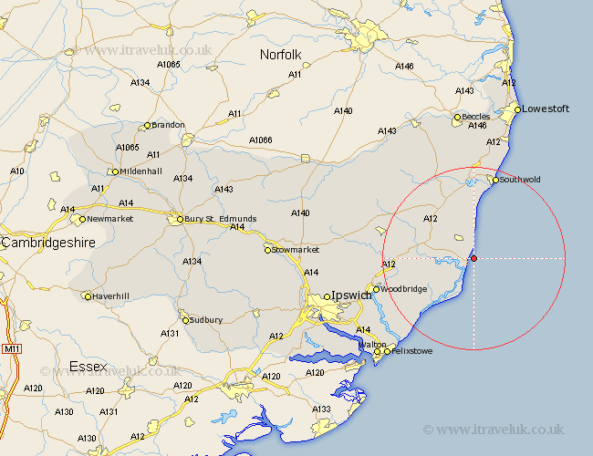
Suffolk Map Showing Location of Thorpe
Population: 745
District: Suffolk Coastal
Easting: 647298 Northing: 258261
Latitude: 52.17 Longitude: 1.62
 = Thorpe
District: Suffolk Coastal
Easting: 647298 Northing: 258261
Latitude: 52.17 Longitude: 1.62
= Thorpe
This Thorpe map below is supplied by Google. Use the tools in the top left corner to zoom into street level or zoom out for a road map, you may also need to zoom in to see Thorpe on the map. Click and drag the map to move around. If the map fails to load try and refresh your browser or zoom in or out (+ or -).
Update - it seems Google no longer allow people to use their maps for free! This Thorpe map sometimes loads and sometimes gives a error. I am working on a solution.
Closest 30 Towns or Cities to Thorpe (Population over 500)
Aldeburgh 2.18km Leiston 5.03km Snape 8.17km Saxmundham 9.7km Orford 10.88km Tunstall 11.96km Yoxford 13.04km Rendlesham 14.74km Wickham Market 17.15km Wenhaston 17.29km Hollesley 18.03km Ufford 19.03km Southwold 19.07km Holton 19.74km Framlingham 20.1km Cookley 20.17km Wangford 20.38km Reydon 20.66km Sutton 21.33km Melton 21.78km Woodbridge 21.78km Halesworth 21.87km Laxfield 22.57km Martlesham 23.52km Dennington 24.27km Wrentham 24.51km Martlesham Heath 25.33km Grundisburgh 26.1km Otley 26.22km Worlingworth 27.34km