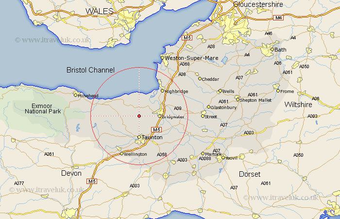
Somerset Map Showing Location of Spaxton
Population: 1021
District: Sedgemoor
Easting: 321848 Northing: 135919
Latitude: 51.12 Longitude: -3.12
 = Spaxton
District: Sedgemoor
Easting: 321848 Northing: 135919
Latitude: 51.12 Longitude: -3.12
= Spaxton
This Spaxton map below is supplied by Google. Use the tools in the top left corner to zoom into street level or zoom out for a road map, you may also need to zoom in to see Spaxton on the map. Click and drag the map to move around. If the map fails to load try and refresh your browser or zoom in or out (+ or -).
Update - it seems Google no longer allow people to use their maps for free! This Spaxton map sometimes loads and sometimes gives a error. I am working on a solution.
Closest 30 Towns or Cities to Spaxton (Population over 500)
Durleigh 4.65km Nether Stowey 5.09km Kingston 5.56km North Petherton 7.22km Bishops Lydeard 7.25km Stoke Courcy 7.5km Stokscourey 7.5km Stogursey 7.5km Otterhampton 7.76km Bridgewater 8.14km Bridgwater 8.14km West Monkton 8.76km Taunton 9.27km Norton Fitzwarren 9.56km Pawlett 11km Puriton 11.85km Oake 12.55km Weston Zoyland 12.8km Stogumber 12.93km Trull 12.98km Huntspill 13.13km Creech St Michael 13.13km Creech Saint Michael 13.13km Creech St. Michael 13.13km Cossington 14.44km Highbridge 14.49km Milverton 14.51km Middlezoy 15.24km North Curry 15.28km Burnham-on-Sea 15.31km