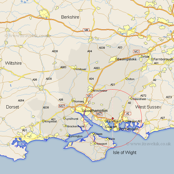
Hampshire Map Showing Location of Southwick
Population: 1368
District: Winchester
Easting: 462153 Northing: 107899
Latitude: 50.87 Longitude: -1.12
 = Southwick
District: Winchester
Easting: 462153 Northing: 107899
Latitude: 50.87 Longitude: -1.12
= Southwick
This Southwick map below is supplied by Google. Use the tools in the top left corner to zoom into street level or zoom out for a road map, you may also need to zoom in to see Southwick on the map. Click and drag the map to move around. If the map fails to load try and refresh your browser or zoom in or out (+ or -).
Update - it seems Google no longer allow people to use their maps for free! This Southwick map sometimes loads and sometimes gives a error. I am working on a solution.
Closest 30 Towns or Cities to Southwick (Population over 500)
Porchester 3.71km Portchester 3.71km Fareham 5.03km Wickham 5.1km Hambledon 6.57km Waterlooville 7.02km Waterloo 7.02km Shidfield 7.26km Shedfield 7.26km Soberton 7.5km Gosport 7.51km Waltham Chase 8.06km Swanmore 8.2km Portsmouth 8.58km Droxford 9.34km Lee-on-the-Solent 9.45km Lee-on-Solent 9.45km Lee on the Solent 9.45km Lee on Solent 9.45km Havant 9.54km Southsea 9.92km Curbridge 10.88km Curdridge 10.88km Horndean 10.88km Clanfield 11.04km Corhampton 11.18km Bishop's Waltham 11.62km Bishops Waltham 11.62km Rowlands Castle 11.84km Botley 11.9km