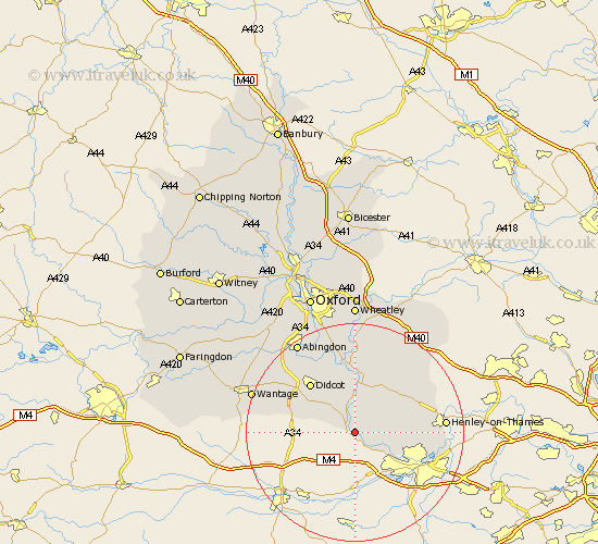
Oxfordshire Map Showing Location of Goring
Population: 4053
Area Size (ha): 186
District: South Oxfordshire
Easting: 460129 Northing: 180162
Latitude: 51.52 Longitude: -1.13
 = Goring
Area Size (ha): 186
District: South Oxfordshire
Easting: 460129 Northing: 180162
Latitude: 51.52 Longitude: -1.13
= Goring
This Goring map below is supplied by Google. Use the tools in the top left corner to zoom into street level or zoom out for a road map, you may also need to zoom in to see Goring on the map. Click and drag the map to move around. If the map fails to load try and refresh your browser or zoom in or out (+ or -).
Update - it seems Google no longer allow people to use their maps for free! This Goring map sometimes loads and sometimes gives a error. I am working on a solution.
Closest 30 Towns or Cities to Goring (Population over 500)
Moulsford 2.18km Whitchurch 5.08km Cholsey 5.68km Blewbury 7.85km Nuffield 8.87km Wallingford 9.26km Chilton 9.94km East Hagbourne 10.13km Hagbourne 10.13km Ewelme 10.35km Warborough 11.12km Rotherfield Peppard 11.68km Nettlebed 11.77km Didcot 12.28km Benson 13.02km Dorchester 13.17km Bix 13.21km Harwell 13.9km Long Wittenham 14.69km Drayton St. Leonard 14.82km Drayton Saint Leonard 14.82km Drayton 14.82km Drayton St Leonard 14.82km Chalgrove 15.22km Clifton Hampden 15.52km Watlington 15.91km Sutton Courtenay 15.91km Milton 16.01km Harpsden 16.15km Henley on Thames 16.25km