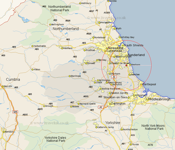
Durham Map Showing Location of Seaton
Population: 1339
District: Easington
Easting: 439606 Northing: 548903
Latitude: 54.83 Longitude: -1.38
 = Seaton
District: Easington
Easting: 439606 Northing: 548903
Latitude: 54.83 Longitude: -1.38
= Seaton
This Seaton map below is supplied by Google. Use the tools in the top left corner to zoom into street level or zoom out for a road map, you may also need to zoom in to see Seaton on the map. Click and drag the map to move around. If the map fails to load try and refresh your browser or zoom in or out (+ or -).
Update - it seems Google no longer allow people to use their maps for free! This Seaton map sometimes loads and sometimes gives a error. I am working on a solution.
Closest 30 Towns or Cities to Seaton (Population over 500)
Seaton 0km Dalton le Dale 2.13km Dalton 2.13km Murton 2.82km Seaham 2.92km Seaham Harbour 2.92km South Hetton 3.85km Hetton le Hole 4.65km Easington 5.56km Houghton le Spring 5.65km Shotton 5.66km Haswell 5.96km Pittington 7.4km West Rainton 7.7km Peterlee 8.23km Sunderland 8.74km Sherburn 9.79km Thornley 9.8km Hesleden 10.2km Wingate 11.12km Horden 11.26km Washington 11.31km Washington New Town 11.31km Chester-le-Street 11.88km Shincliffe 12.14km Birtley 12.98km Hutton Henry 13.14km Whitburn 13.38km Durham 13.89km Bowburn 14.02km