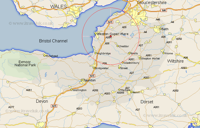
Somerset Map Showing Location of Sandford
Population: 4332
Easting: 341951 Northing: 159741
Latitude: 51.33 Longitude: -2.83
 = Sandford
Easting: 341951 Northing: 159741
Latitude: 51.33 Longitude: -2.83
= Sandford
This Sandford map below is supplied by Google. Use the tools in the top left corner to zoom into street level or zoom out for a road map, you may also need to zoom in to see Sandford on the map. Click and drag the map to move around. If the map fails to load try and refresh your browser or zoom in or out (+ or -).
Update - it seems Google no longer allow people to use their maps for free! This Sandford map sometimes loads and sometimes gives a error. I am working on a solution.
Closest 30 Towns or Cities to Sandford (Population over 500)
Churchill 2.32km Banwell 2.96km Locking 3.47km Shipham 4.37km Congresbury 4.38km Yatton 5.68km Wrington 5.94km Axbridge 6.02km Hutton 7.19km Weare 7.41km Wick St. Lawrence 8.02km Wick Saint Lawrence 8.02km Wick St Lawrence 8.02km Blagdon 8.1km Cheddar 8.74km Bleadon 8.91km Lympsham 9.83km Priddy 10.36km Weston-Super-Mare 10.58km Clevedon 11.18km Rodney Stoke 11.58km Nailsea 12.04km Wedmore 13.02km Flax Bourton 13.1km Bourton 13.1km Brent Knoll 13.11km Compton Martin 13.27km Westbury 13.76km Mark 13.77km Winford 13.89km