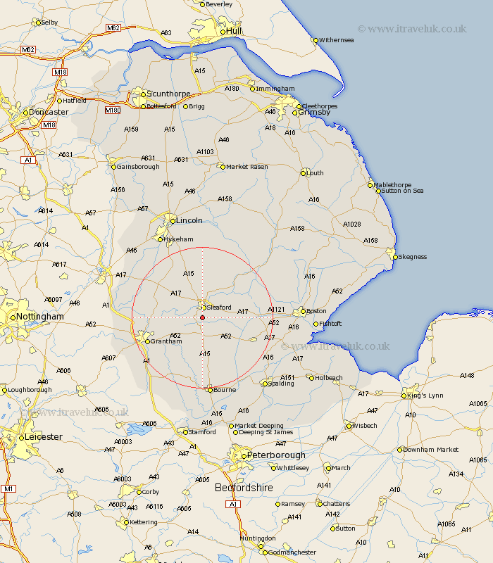
Lincolnshire Map Showing Location of Quarington
District: North Kesteven
Easting: 506325 Northing: 342245
Latitude: 52.97 Longitude: -0.42
 = Quarington
Easting: 506325 Northing: 342245
Latitude: 52.97 Longitude: -0.42
= Quarington
This Quarington map below is supplied by Google. Use the tools in the top left corner to zoom into street level or zoom out for a road map, you may also need to zoom in to see Quarington on the map. Click and drag the map to move around. If the map fails to load try and refresh your browser or zoom in or out (+ or -).
Update - it seems Google no longer allow people to use their maps for free! This Quarington map sometimes loads and sometimes gives a error. I am working on a solution.
Closest 30 Towns or Cities to Quarington (Population over 500)
Sleaford 2.99km Heasingham 5.56km Leasingham 5.56km Buskington 7.73km Ruskington 7.73km Ancaster 7.81km Cranwell 8.13km Helpringham 8.65km Heckington 8.93km Hale 9.12km Great Hale 9.12km Brauncewell 9.33km Billingborough 10.83km Folkingham 11.18km Ropsley 11.44km Belton 12.83km Bloxholm 12.96km Bloxholme 12.96km Fulbeck 13.39km Digby 13.39km Caythorpe 13.47km Pointon 14.13km Welbourn 14.25km Scopwick 14.86km Billinghay 15.74km Navenby 16.26km Grantham 16.31km Donington 16.31km Wellingore 16.75km Rippingale 17.01km