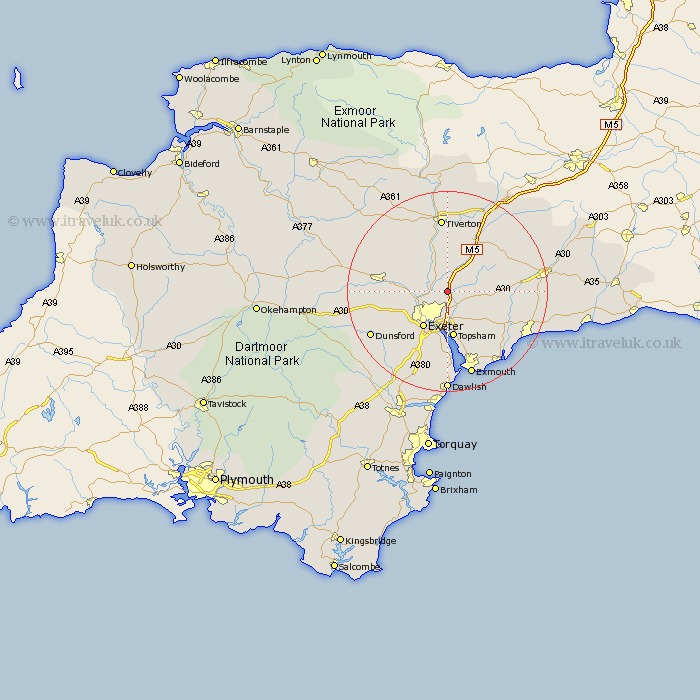
Devon Map Showing Location of Poltimore
Population: 297
District: East Devon
Easting: 296581 Northing: 97434
Latitude: 50.77 Longitude: -3.47
 = Poltimore
District: East Devon
Easting: 296581 Northing: 97434
Latitude: 50.77 Longitude: -3.47
= Poltimore
This Poltimore map below is supplied by Google. Use the tools in the top left corner to zoom into street level or zoom out for a road map, you may also need to zoom in to see Poltimore on the map. Click and drag the map to move around. If the map fails to load try and refresh your browser or zoom in or out (+ or -).
Update - it seems Google no longer allow people to use their maps for free! This Poltimore map sometimes loads and sometimes gives a error. I am working on a solution.
Closest 30 Towns or Cities to Poltimore (Population over 500)
Stoke Canon 2.34km Broad Clyst 2.34km Silverton 5.68km Thorverton 5.97km Rockbeare 6.15km Bradninch 8.2km Whimple 8.2km Exeter 8.78km Aylesbeare 8.97km Topsham 9.34km Exminster 9.35km St. Cyres 9.38km Saint Cyres 9.38km St Cyres 9.38km Newton St Cyres 9.38km Newton St. Cyres 9.38km Newton Saint Cyres 9.38km Plymtree 9.91km Whitestone 10.09km Ide 10.22km Woodbury Road Station 10.39km Talaton 10.71km Cullompton 12.06km Payhembury 12.29km Holcombe Burnell 12.98km Crediton 13.02km Lympstone 13.45km Newton Poppleford 13.88km Cheriton Fitzpaine 14.03km Colyton Raleigh 14.05km