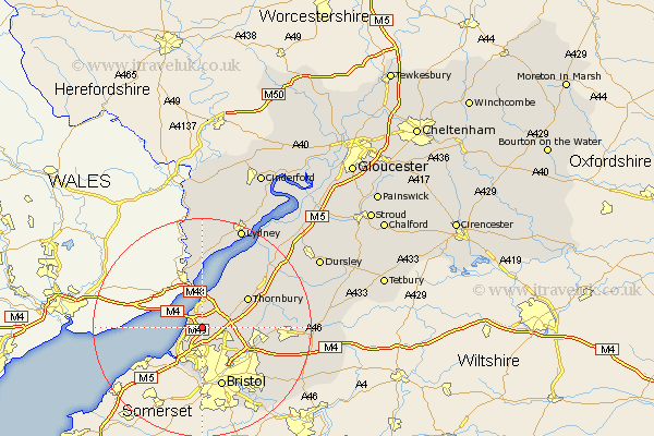
Gloucestershire Map Showing Location of Pilning
Population: 3442
Easting: 356091 Northing: 183699
Latitude: 51.55 Longitude: -2.63
 = Pilning
Easting: 356091 Northing: 183699
Latitude: 51.55 Longitude: -2.63
= Pilning
This Pilning map below is supplied by Google. Use the tools in the top left corner to zoom into street level or zoom out for a road map, you may also need to zoom in to see Pilning on the map. Click and drag the map to move around. If the map fails to load try and refresh your browser or zoom in or out (+ or -).
Update - it seems Google no longer allow people to use their maps for free! This Pilning map sometimes loads and sometimes gives a error. I am working on a solution.
Closest 30 Towns or Cities to Pilning (Population over 500)
Almondsbury 4.61km Patchway 4.97km Aust 5.68km Olveston 5.91km Filton 5.92km Stoke Gifford 6.85km Alveston 8.87km Thornbury 9.79km Winterbourne 10.03km Frampton Cotterell 10.54km Tidenham 11.18km Iron Acton 11.52km Bristol 11.65km Tytherington 11.76km Rangeworthy 12.81km Kingswood 13.07km Mangotsfield 13.71km Westerleigh 14.32km Cromhall 14.68km Falfield 15.69km Siston 15.71km Stone 16km Charfield 16.71km Woolaston 16.84km Chipping Sodbury 17.39km Wickwar 17.67km Wick 17.76km Berkeley 19.49km Bitton 19.51km Lydney 19.78km