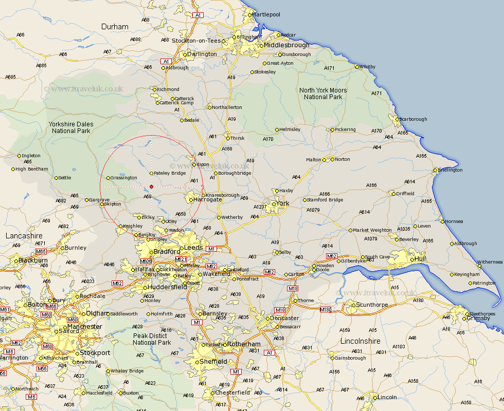
Yorkshire Map Showing Location of Padside
Population: 199
District: Harrogate
Easting: 416372 Northing: 459751
Latitude: 54.03 Longitude: -1.75
 = Padside
District: Harrogate
Easting: 416372 Northing: 459751
Latitude: 54.03 Longitude: -1.75
= Padside
This Padside map below is supplied by Google. Use the tools in the top left corner to zoom into street level or zoom out for a road map, you may also need to zoom in to see Padside on the map. Click and drag the map to move around. If the map fails to load try and refresh your browser or zoom in or out (+ or -).
Update - it seems Google no longer allow people to use their maps for free! This Padside map sometimes loads and sometimes gives a error. I am working on a solution.
Closest 30 Towns or Cities to Padside (Population over 500)
Dacre 2.86km Darley 3.27km Bewerley 5.67km Birstwith 8.71km Hampsthwaite 9.97km Burley 12.97km Burley in Wharfedale 12.97km Killinghall 13.19km Ilkley 13.68km Addingham 14.13km Harrogate 15.21km Otley 15.45km Grassington 15.68km Kirkby Malzeard 16.2km Menston 16.72km Burton Leonard 16.74km Pannal 16.92km Embsay 16.95km Poole 17.2km Pool-in-Wharfedale 17.2km Pool 17.2km Bishop Monkton 17.24km Monkton 17.24km Threshfield 17.51km Weeton 17.66km Arthington 17.78km Arthington Junction Station 17.78km Ripon 17.83km Grewelthorpe 17.91km Guiseley 18.65km