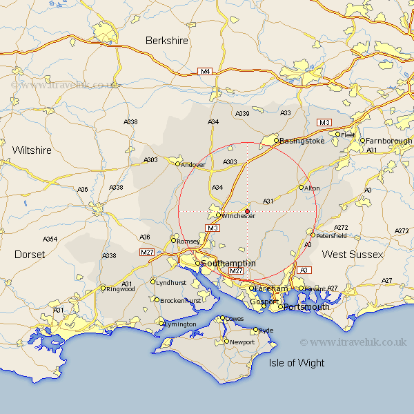
Hampshire Map Showing Location of Ovington
Population: 221
District: Winchester
Easting: 456049 Northing: 130071
Latitude: 51.07 Longitude: -1.2
 = Ovington
District: Winchester
Easting: 456049 Northing: 130071
Latitude: 51.07 Longitude: -1.2
= Ovington
This Ovington map below is supplied by Google. Use the tools in the top left corner to zoom into street level or zoom out for a road map, you may also need to zoom in to see Ovington on the map. Click and drag the map to move around. If the map fails to load try and refresh your browser or zoom in or out (+ or -).
Update - it seems Google no longer allow people to use their maps for free! This Ovington map sometimes loads and sometimes gives a error. I am working on a solution.
Closest 30 Towns or Cities to Ovington (Population over 500)
New Alresford 2.97km Cheriton 2.98km Bramdean 6.91km Kings Worthy 7.23km Ropley 8.15km Winchester 8.23km Micheldever 8.75km Owslebury 8.76km West Meon 9.87km Twyford 9.87km Medstead 10.85km Compton 10.85km Upham 11.36km Four Marks 11.86km Corhampton 12.06km Wonston 12.33km Sparsholt 12.81km Otterbourne 12.85km Bishops Waltham 13.03km Bishop's Waltham 13.03km Durley 13.44km Droxford 13.79km Bishopstoke 14.51km North Waltham 14.87km East Meon 14.9km Swanmore 15.01km Froxfield 15.05km Hursley 15.05km Dummer 15.23km Eastleigh 15.29km