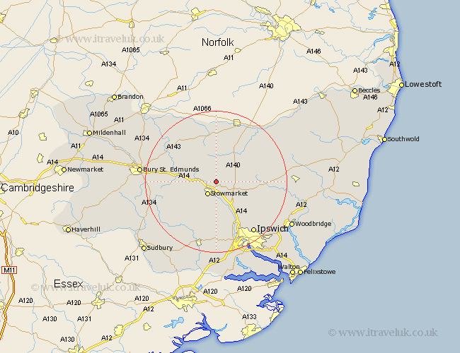
Suffolk Map Showing Location of Old Newton
Population: 995
District: Mid Suffolk
Easting: 606051 Northing: 261942
Latitude: 52.22 Longitude: 1.02
 = Old Newton
District: Mid Suffolk
Easting: 606051 Northing: 261942
Latitude: 52.22 Longitude: 1.02
= Old Newton
This Old Newton map below is supplied by Google. Use the tools in the top left corner to zoom into street level or zoom out for a road map, you may also need to zoom in to see Old Newton on the map. Click and drag the map to move around. If the map fails to load try and refresh your browser or zoom in or out (+ or -).
Update - it seems Google no longer allow people to use their maps for free! This Old Newton map sometimes loads and sometimes gives a error. I am working on a solution.
Closest 30 Towns or Cities to Old Newton (Population over 500)
Haughley 2.27km Stowmarket 4.35km Mendlesham 5.03km Bacton 5.56km Elmswell 7.06km Finborough 7.95km Great Finborough 7.95km Woolpit 7.95km Gislingham 9.54km Ringshall 9.55km Rattlesden 9.82km Badwell Ash 10.06km Thorndon 10.86km Norton 10.87km Great Bricett 11.35km Debenham 11.35km Coddenham 11.51km Botesdale 12.97km Somersham 13.17km Stanton 13.66km Pakenham 13.67km Hitcham 13.67km Thurston 14.12km Great Blakenham 14.17km Eye 14.35km Henley 14.36km Hepworth 14.64km Bildeston 14.66km Bradfield 14.88km Bradfield St. George 14.88km