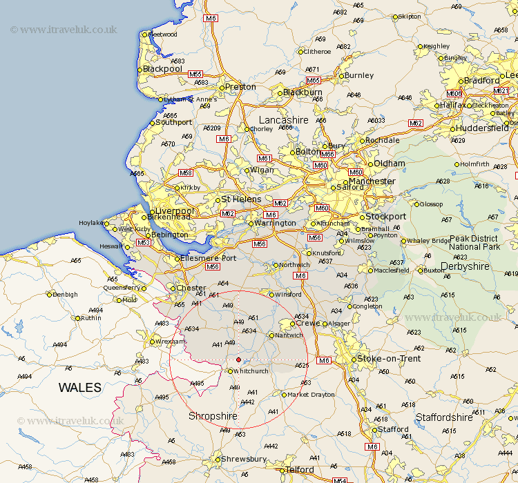
Cheshire Map Showing Location of Marbury
Population: 244
District: Crewe and Nantwich
Easting: 356382 Northing: 344973
Latitude: 53 Longitude: -2.65
 = Marbury
District: Crewe and Nantwich
Easting: 356382 Northing: 344973
Latitude: 53 Longitude: -2.65
= Marbury
This Marbury map below is supplied by Google. Use the tools in the top left corner to zoom into street level or zoom out for a road map, you may also need to zoom in to see Marbury on the map. Click and drag the map to move around. If the map fails to load try and refresh your browser or zoom in or out (+ or -).
Update - it seems Google no longer allow people to use their maps for free! This Marbury map sometimes loads and sometimes gives a error. I am working on a solution.
Closest 30 Towns or Cities to Marbury (Population over 500)
Wrenbury 3.83km Wrenbury cum Frith 3.83km Malpas 8.02km Audlem 9.12km Harthill 11.42km Nantwich 11.6km Tilston 12.46km Bunbury 12.98km Willaston 13.39km Wybunbury 13.88km Tattenhall 15.14km Wistaston 15.36km Tarporley 16.72km Farndon 18.14km Crewe 18.26km Little Budworth 20.65km Waverton 21.07km Winsford 22.24km Tarvin 23.56km Christleton 23.78km Sandbach 24.04km Delamere 24.12km Kelsall Hill 24.2km Kelshall Hill 24.2km Kelsall 24.2km Barrow 24.39km Great Barrow 24.39km Ashton 24.73km Dodleston 24.93km Middlewick 25km