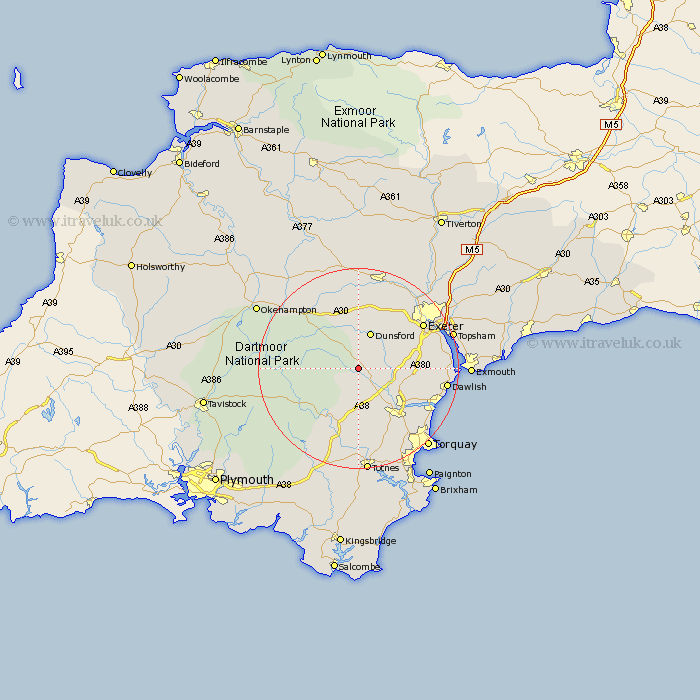
Devon Map Showing Location of Lustleigh
Population: 626
District: Teignbridge
Easting: 278567 Northing: 81136
Latitude: 50.62 Longitude: -3.72
 = Lustleigh
District: Teignbridge
Easting: 278567 Northing: 81136
Latitude: 50.62 Longitude: -3.72
= Lustleigh
This Lustleigh map below is supplied by Google. Use the tools in the top left corner to zoom into street level or zoom out for a road map, you may also need to zoom in to see Lustleigh on the map. Click and drag the map to move around. If the map fails to load try and refresh your browser or zoom in or out (+ or -).
Update - it seems Google no longer allow people to use their maps for free! This Lustleigh map sometimes loads and sometimes gives a error. I am working on a solution.
Closest 30 Towns or Cities to Lustleigh (Population over 500)
Hennock 3.99km Moretonhampstead 4.39km Bovey Tracey 4.39km Ilsington 5.68km Christow 5.99km Dunsford 7.77km Widdecombe 8.09km Widecombe in the Moor 8.09km Chudleigh 9.59km Drewsteignton 10.39km Chagford 11.07km Ashburton 11.37km Kingsteignton 11.98km Newton Abbot 12.4km Holcombe Burnell 12.58km Cheriton Bishop 13.02km Tedburn St. Mary 13.18km Tedburn St Mary 13.18km Tedburn Saint Mary 13.18km Denbury 13.8km Ide 14.06km Dartmoor Forest 14.6km Abbotskerswell 14.77km Bishopsteignton 14.92km Broadhempston 15.02km Whitestone 15.35km Buckfastleigh 15.56km Exeter 15.9km Ipplepen 15.96km Kingskerswell 16.03km