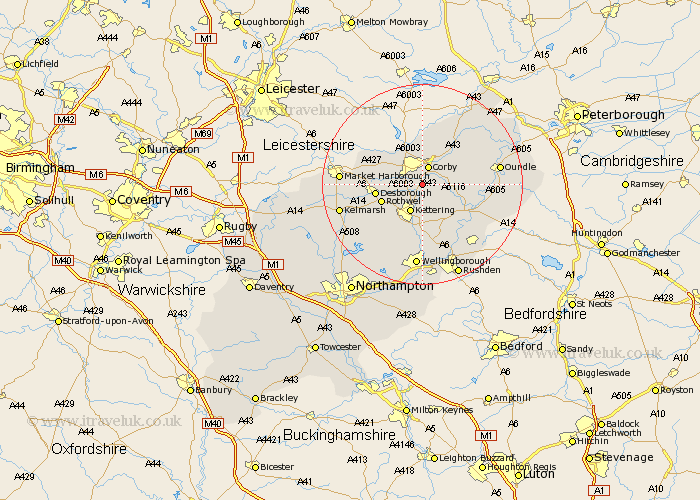
Northamptonshire Map Showing Location of Little Oakley
Population: 147
District: Kettering
Easting: 489470 Northing: 284416
Latitude: 52.45 Longitude: -0.68
 = Little Oakley
District: Kettering
Easting: 489470 Northing: 284416
Latitude: 52.45 Longitude: -0.68
= Little Oakley
This Little Oakley map below is supplied by Google. Use the tools in the top left corner to zoom into street level or zoom out for a road map, you may also need to zoom in to see Little Oakley on the map. Click and drag the map to move around. If the map fails to load try and refresh your browser or zoom in or out (+ or -).
Update - it seems Google no longer allow people to use their maps for free! This Little Oakley map sometimes loads and sometimes gives a error. I am working on a solution.
Closest 30 Towns or Cities to Little Oakley (Population over 500)
Geddington 1.86km Stanion 2.92km Corby 3.87km Weldon 5.02km Brigstock 5.65km Cottingham 5.84km Kettering 6km Caldecott 7.75km Wilbarston 8.73km Rowell 8.73km Rothwell 8.73km Desborough 9.23km Gretton 9.33km Broughton 10.85km Burton Latimer 11.18km Isham 11.18km Thrapston 11.59km Woodford 12.19km Islip 12.59km Finedon 13.41km Ringstead 14.33km Titchmarsh 14.66km Oundle 15.14km Walgrave 15.82km Irthlingborough 15.86km Raunds 16.49km Wellingborough 16.72km Stanwick 17.37km Kings Cliffe 17.95km King's Cliffe 17.95km