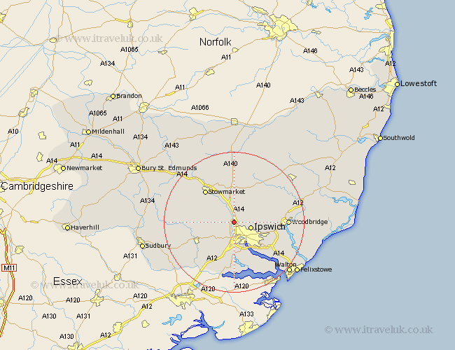
Suffolk Map Showing Location of Great Blakenham
Population: 1083
District: Mid Suffolk
Easting: 612296 Northing: 249208
Latitude: 52.1 Longitude: 1.1
 = Great Blakenham
District: Mid Suffolk
Easting: 612296 Northing: 249208
Latitude: 52.1 Longitude: 1.1
= Great Blakenham
This Great Blakenham map below is supplied by Google. Use the tools in the top left corner to zoom into street level or zoom out for a road map, you may also need to zoom in to see Great Blakenham on the map. Click and drag the map to move around. If the map fails to load try and refresh your browser or zoom in or out (+ or -).
Update - it seems Google no longer allow people to use their maps for free! This Great Blakenham map sometimes loads and sometimes gives a error. I am working on a solution.
Closest 30 Towns or Cities to Great Blakenham (Population over 500)
Claydon 2.18km Somersham 3.41km Bramford 3.7km Coddenham 3.87km Henley 3.89km Ipswich 4.92km Sproughton 5.56km Sprughton 5.56km Witnesham 5.69km Wirnesham 5.69km Hintlesham 6.53km Great Bricett 8.18km Ringshall 8.78km Grundisburgh 10.25km Otley 10.67km Capel St. Mary 11.35km Capel Saint Mary 11.35km Capel 11.35km Capel St Mary 11.35km Hadleigh 11.66km Stowmarket 12.21km Bildeston 12.52km Bucklesham 12.65km Layham 13km Nacton 13km Bentley 13.03km Martlesham Heath 13.06km Finborough 13.58km Great Finborough 13.58km Holbrook 13.75km