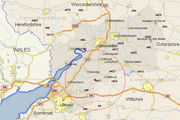
Gloucestershire Map Showing Location of Leighterton
Population: 232
District: Cotswold
Easting: 381538 Northing: 190960
Latitude: 51.62 Longitude: -2.27
 = Leighterton
District: Cotswold
Easting: 381538 Northing: 190960
Latitude: 51.62 Longitude: -2.27
= Leighterton
This Leighterton map below is supplied by Google. Use the tools in the top left corner to zoom into street level or zoom out for a road map, you may also need to zoom in to see Leighterton on the map. Click and drag the map to move around. If the map fails to load try and refresh your browser or zoom in or out (+ or -).
Update - it seems Google no longer allow people to use their maps for free! This Leighterton map sometimes loads and sometimes gives a error. I am working on a solution.
Closest 30 Towns or Cities to Leighterton (Population over 500)
Hawkesbury 5.91km Wotton under Edge 6.04km Wotton-under-Edge 6.04km Tetbury 7.15km Dursley 7.22km Horsley 7.76km Uley 8.17km Nailsworth 8.72km Wickwar 8.87km North Nibley 9.78km Avening 10.12km Charfield 10.36km Cam 10.9km Woodchester 11.36km Minchinhampton 11.55km Coaley 12.03km Chipping Sodbury 12.29km Cromhall 12.66km Falfield 12.79km Slimbridge 13.73km Rangeworthy 13.83km Stone 14.29km Berkeley 14.66km Chalford 14.69km Stonehouse 14.87km Tytherington 15.08km Stroud 15.52km Iron Acton 15.68km Westerleigh 16.01km Randwick 16.72km