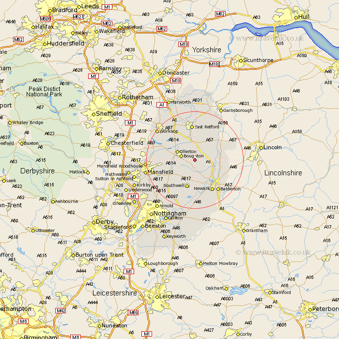
Nottinghamshire Map Showing Location of Laxton
Population: 296
District: Newark and Sherwood
Easting: 472386 Northing: 365713
Latitude: 53.18 Longitude: -0.92
 = Laxton
District: Newark and Sherwood
Easting: 472386 Northing: 365713
Latitude: 53.18 Longitude: -0.92
= Laxton
This Laxton map below is supplied by Google. Use the tools in the top left corner to zoom into street level or zoom out for a road map, you may also need to zoom in to see Laxton on the map. Click and drag the map to move around. If the map fails to load try and refresh your browser or zoom in or out (+ or -).
Update - it seems Google no longer allow people to use their maps for free! This Laxton map sometimes loads and sometimes gives a error. I am working on a solution.
Closest 30 Towns or Cities to Laxton (Population over 500)
Tuxford 4.33km Boughton 5.43km Walesby 7.11km Ollerton 7.63km Markham 7.74km East Markham 7.74km Bilsthorpe 9.56km Elkesley 9.85km Elksley 9.85km North Muskham 9.97km Muskham 9.97km Edwinstowe 10km North Collingham 11.71km Collingham 11.71km Southwell 11.88km Farnsfield 12.1km Clipstone 12.36km Winthorpe 12.84km Grove 13.02km Newark-on-Trent 14.58km Newark 14.58km Newark upon Trent 14.58km Newark on Trent 14.58km Fiskerton Ferry 14.86km Fiskerton 14.86km East Retford 14.87km Rampton 15.12km Bampton 15.12km Rainworth 15.26km Farndon 15.48km