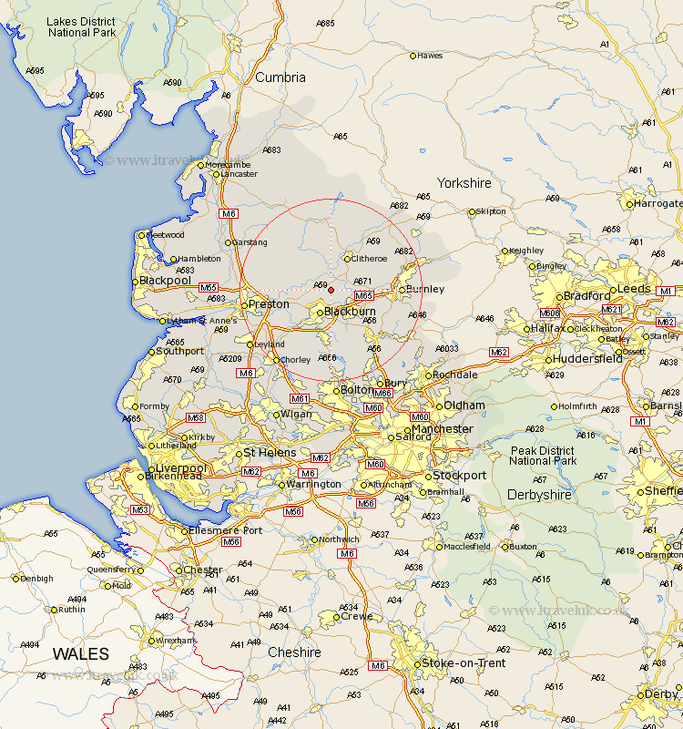
Lancashire Map Showing Location of Langho
Population: 2056
Area Size (ha): 63
District: Ribble Valley
Easting: 370364 Northing: 433861
Latitude: 53.8 Longitude: -2.45
 = Langho
Area Size (ha): 63
District: Ribble Valley
Easting: 370364 Northing: 433861
Latitude: 53.8 Longitude: -2.45
= Langho
This Langho map below is supplied by Google. Use the tools in the top left corner to zoom into street level or zoom out for a road map, you may also need to zoom in to see Langho on the map. Click and drag the map to move around. If the map fails to load try and refresh your browser or zoom in or out (+ or -).
Update - it seems Google no longer allow people to use their maps for free! This Langho map sometimes loads and sometimes gives a error. I am working on a solution.
Closest 30 Towns or Cities to Langho (Population over 500)
Whalley 2.87km Great Harwood 2.87km Wilpshire 2.87km Ribchester 5.47km Clayton-le-Moors 5.74km Clayton le Moor 5.74km Clayton le Moors 5.74km Rishton 5.97km Blackburn 5.97km Mellor 6.61km Simonstone 6.83km Church 7.08km Accrington 7.54km Sabden 7.88km Altham 7.88km Clitheroe 8.11km Oswaldtwistle 8.11km Padiham 8.95km Hapton 8.95km Longridge 9.5km Waddington 9.52km Darwen 11.17km Chatburn 11.35km Samlesbury 11.56km Grimsargh 12.04km Grindleton 12.39km Chipping 12.74km Hoghton 12.75km Withnell 12.92km Haslingden 13.51km