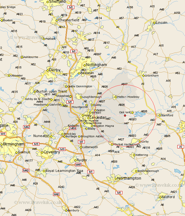
Leicestershire Map Showing Location of Knossington
Population: 341
District: Melton
Easting: 481172 Northing: 306522
Latitude: 52.65 Longitude: -0.8
 = Knossington
District: Melton
Easting: 481172 Northing: 306522
Latitude: 52.65 Longitude: -0.8
= Knossington
This Knossington map below is supplied by Google. Use the tools in the top left corner to zoom into street level or zoom out for a road map, you may also need to zoom in to see Knossington on the map. Click and drag the map to move around. If the map fails to load try and refresh your browser or zoom in or out (+ or -).
Update - it seems Google no longer allow people to use their maps for free! This Knossington map sometimes loads and sometimes gives a error. I am working on a solution.
Closest 30 Towns or Cities to Knossington (Population over 500)
Somerby 2.92km Twyford 8.08km Billesdon 10.58km Hallaton 11.34km Wymondham 11.99km Gaddesby 12.54km Houghton-on-the-Hill 12.91km Houghton 12.91km Houghton on the Hill 12.91km Melton Mowbray 14.14km Frisby 14.56km Frisby-on-the-Wreak 14.56km Frisby on the Wreak 14.56km Great Easton 15.2km Queniboro 16.16km Queniborough 16.16km Hoby 16.35km Waltham on the Wolds 16.68km Waltham 16.68km Waltham-on-the-Wolds 16.68km Abkettley 16.78km Ab Kettleby 16.78km Scalford 17.27km Rearsby 17.39km Kibworth 17.94km Kibworth Harcourt 17.94km Great Glen 18.28km Syston 18.36km Great Bowden 19.73km Bowden 19.73km