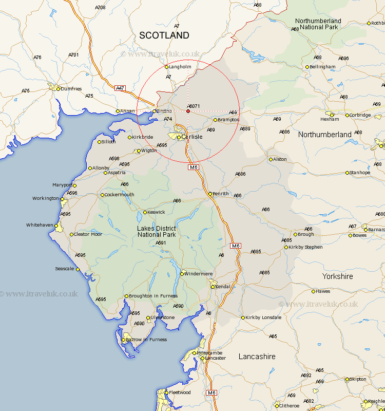
Cumbria Map Showing Location of Kirklinton
Population: 369
District: Carlisle
Easting: 343477 Northing: 565776
Latitude: 54.98 Longitude: -2.88
 = Kirklinton
District: Carlisle
Easting: 343477 Northing: 565776
Latitude: 54.98 Longitude: -2.88
= Kirklinton
This Kirklinton map below is supplied by Google. Use the tools in the top left corner to zoom into street level or zoom out for a road map, you may also need to zoom in to see Kirklinton on the map. Click and drag the map to move around. If the map fails to load try and refresh your browser or zoom in or out (+ or -).
Update - it seems Google no longer allow people to use their maps for free! This Kirklinton map sometimes loads and sometimes gives a error. I am working on a solution.
Closest 30 Towns or Cities to Kirklinton (Population over 500)
Longtown 5.63km Rockcliff 8.47km Rockcliffe 8.47km Irthington 9.3km Stanwix 9.8km Brampton 10.27km Carlisle 11.57km Hayton 12.58km Burgh-by-Sands 12.97km Burgh by Sands 12.97km Burgh 12.97km Wetheral 13.65km Farlam 14.76km Dalston 17.86km Thursby 19.79km Bowness-on-Solway 21.6km Bowness on Solway 21.6km Ainstable 22.53km Kirkbride 23.08km Wigton 23.85km Kirkoswald 26.79km Westward 27.39km Hesket Newmarket 29.08km Caldbeck 29.78km Lazonby 30.17km Lasonby 30.17km Skelton 31.52km Bromfield 31.88km Silloth 33.5km Langwathby 36.13km