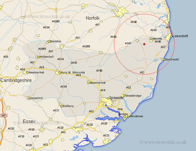
Suffolk Map Showing Location of Ilketshall
Population: 279
District: Waveney
Easting: 637889 Northing: 287506
Latitude: 52.43 Longitude: 1.5
 = Ilketshall
District: Waveney
Easting: 637889 Northing: 287506
Latitude: 52.43 Longitude: 1.5
= Ilketshall
This Ilketshall map below is supplied by Google. Use the tools in the top left corner to zoom into street level or zoom out for a road map, you may also need to zoom in to see Ilketshall on the map. Click and drag the map to move around. If the map fails to load try and refresh your browser or zoom in or out (+ or -).
Update - it seems Google no longer allow people to use their maps for free! This Ilketshall map sometimes loads and sometimes gives a error. I am working on a solution.
Closest 30 Towns or Cities to Ilketshall (Population over 500)
Bungay 3.86km Beccles 5.85km Worlingham 5.95km Halesworth 9.26km Holton 11.17km Wangford 12.18km Wenhaston 13.4km Cookley 13.4km Wrentham 13.62km Carlton Colville 13.68km Reydon 14.62km Gisleham 14.69km Kessingland 14.81km Fressingfield 16.43km Southwold 16.69km Oulton 16.76km Laxfield 17.37km Lowestoft 17.83km Yoxford 18.56km Corton 20.3km Stradbroke 20.47km Hoxne 22.37km Dennington 22.97km Saxmundham 24.09km Worlingworth 25.13km Leiston 26.33km Framlingham 26.62km Eye 27.07km Snape 27.8km Thorndon 29.97km