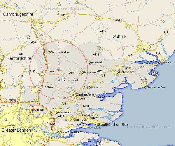
Essex Map Showing Location of Great Easton
Population: 797
District: Uttlesford
Easting: 560515 Northing: 225005
Latitude: 51.9 Longitude: 0.33
 = Great Easton
District: Uttlesford
Easting: 560515 Northing: 225005
Latitude: 51.9 Longitude: 0.33
= Great Easton
This Great Easton map below is supplied by Google. Use the tools in the top left corner to zoom into street level or zoom out for a road map, you may also need to zoom in to see Great Easton on the map. Click and drag the map to move around. If the map fails to load try and refresh your browser or zoom in or out (+ or -).
Update - it seems Google no longer allow people to use their maps for free! This Great Easton map sometimes loads and sometimes gives a error. I am working on a solution.
Closest 30 Towns or Cities to Great Easton (Population over 500)
Broxted 2.95km Dunmow 2.95km Great Dunmow 2.95km Takeley 5.89km Thaxted 6.01km Stebbing 6.01km Henham 6.81km Elsenham 7.11km Barnston 7.2km Felsted 7.2km Debden 8.71km Stansted 9.15km Stansted Mountfitchet 9.15km Stansted Apt 9.15km Hatfield Broad Oak 9.37km Great Sampford 10.33km Birchanger 10.46km Quendon 10.7km Newport 10.88km Finchingfield 10.91km Great Bardfield 10.93km Radwinter 11.12km Wimbish 11.18km Wenbech 11.18km Wymbyshe 11.18km Winbeche 11.18km Wimbeis 11.18km Winebisc 11.18km Gwimbach 11.18km High Easter 11.18km