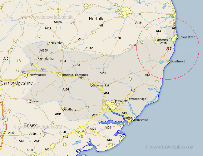
Suffolk Map Showing Location of Henstead
Population: 346
District: Waveney
Easting: 649307 Northing: 286223
Latitude: 52.42 Longitude: 1.67
 = Henstead
District: Waveney
Easting: 649307 Northing: 286223
Latitude: 52.42 Longitude: 1.67
= Henstead
This Henstead map below is supplied by Google. Use the tools in the top left corner to zoom into street level or zoom out for a road map, you may also need to zoom in to see Henstead on the map. Click and drag the map to move around. If the map fails to load try and refresh your browser or zoom in or out (+ or -).
Update - it seems Google no longer allow people to use their maps for free! This Henstead map sometimes loads and sometimes gives a error. I am working on a solution.
Closest 30 Towns or Cities to Henstead (Population over 500)
Kessingland 3.39km Gisleham 3.86km Wrentham 3.88km Carlton Colville 4.34km Worlingham 6.75km Reydon 7.42km Wangford 8.16km Oulton 8.67km Beccles 8.77km Lowestoft 9.31km Southwold 9.34km Corton 13.02km Halesworth 13.53km Wenhaston 13.65km Holton 13.77km Bungay 15.15km Cookley 18.44km Yoxford 19.55km Laxfield 24.15km Saxmundham 24.96km Leiston 25.04km Fressingfield 25.97km Thorpeness 28.01km Thorpe 28.01km Snape 28.32km Stradbroke 29.35km Dennington 29.98km Aldeburgh 30km Framlingham 31.75km Hoxne 32.53km