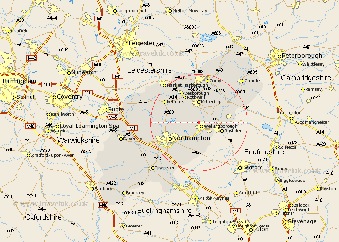
Northamptonshire Map Showing Location of Harrowden
Population: 74
District: Wellingborough
Easting: 487468 Northing: 269551
Latitude: 52.32 Longitude: -0.72
 = Harrowden
District: Wellingborough
Easting: 487468 Northing: 269551
Latitude: 52.32 Longitude: -0.72
= Harrowden
This Harrowden map below is supplied by Google. Use the tools in the top left corner to zoom into street level or zoom out for a road map, you may also need to zoom in to see Harrowden on the map. Click and drag the map to move around. If the map fails to load try and refresh your browser or zoom in or out (+ or -).
Update - it seems Google no longer allow people to use their maps for free! This Harrowden map sometimes loads and sometimes gives a error. I am working on a solution.
Closest 30 Towns or Cities to Harrowden (Population over 500)
Wellingborough 2.18km Isham 3.87km Burton Latimer 5.02km Wilby 5.56km Great Doddington 5.67km Doddington 5.67km Sywell 5.86km Finedon 5.96km Broughton 6.52km Walgrave 7.04km Overstone 7.75km Earls Barton 7.76km Irthlingborough 7.93km Irchester 7.94km Wollaston 8.16km Higham Ferrers 9.25km Kettering 9.26km Whiston 9.55km Rushden 9.8km Moulton 9.8km Great Billing 10.06km Billing 10.06km Stanwick 11.33km Pitsford 11.48km Woodford 11.61km Bozeat 11.63km Ringstead 11.91km Brixworth 12.46km Rothwell 12.48km Rowell 12.48km