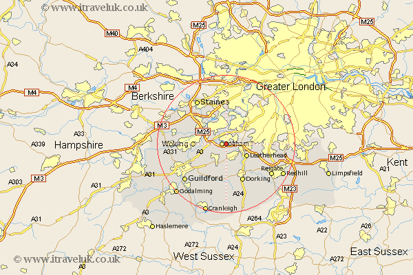
Surrey Map Showing Location of Downside
District: Elmbridge
Easting: 511491 Northing: 158781
Latitude: 51.32 Longitude: -0.4
 = Downside
Easting: 511491 Northing: 158781
Latitude: 51.32 Longitude: -0.4
= Downside
This Downside map below is supplied by Google. Use the tools in the top left corner to zoom into street level or zoom out for a road map, you may also need to zoom in to see Downside on the map. Click and drag the map to move around. If the map fails to load try and refresh your browser or zoom in or out (+ or -).
Update - it seems Google no longer allow people to use their maps for free! This Downside map sometimes loads and sometimes gives a error. I am working on a solution.
Closest 30 Towns or Cities to Downside (Population over 500)
Church Cobham 1.16km Cobham 1.16km Oxshott 3.47km Esher 4.37km Byfleet 4.99km Claygate 5.08km West Horsley 6.56km Ripley 6.88km Leatherhead 6.88km Weybridge 7.23km Effingham 7.42km Walton 7.76km Walton upon Thames 7.76km East Horsley 7.77km Horsley 7.77km Addlestone 8.03km Shepperton 8.18km Sunbury on Thames 9.26km Sunbury 9.26km Lower Sunbury 9.26km Sunbury-on-Thames 9.26km Woking 9.27km Mickleham 9.41km Molesey 9.89km Ottershaw 9.98km Send 9.99km Chertsey 10.15km West Clandon 10.17km Westcott 11.65km Dorking 12.05km