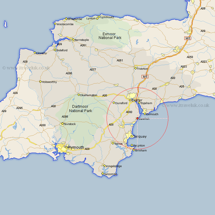
Devon Map Showing Location of Dawlish
Population: 9612
Area Size (ha): 226
District: Teignbridge
Easting: 296177 Northing: 77043
Latitude: 50.58 Longitude: -3.47
 = Dawlish
Area Size (ha): 226
District: Teignbridge
Easting: 296177 Northing: 77043
Latitude: 50.58 Longitude: -3.47
= Dawlish
This Dawlish map below is supplied by Google. Use the tools in the top left corner to zoom into street level or zoom out for a road map, you may also need to zoom in to see Dawlish on the map. Click and drag the map to move around. If the map fails to load try and refresh your browser or zoom in or out (+ or -).
Update - it seems Google no longer allow people to use their maps for free! This Dawlish map sometimes loads and sometimes gives a error. I am working on a solution.
Closest 30 Towns or Cities to Dawlish (Population over 500)
Teignmouth 3.7km Starcross 3.9km Kenton 5.56km Exmouth 5.77km Bishopsteignton 5.99km Lympstone 8.21km Chudleigh 8.44km Stokeinteignhead 8.78km Kingsteignton 9.03km Budleigh Salterton 10.93km Newton Abbot 10.94km Exminster 11.18km Topsham 11.19km Woodbury Road Station 12.07km Kingskerswell 12.4km East Budleigh 12.92km Torquay 13.15km Exeter 13.8km Abbotskerswell 14.08km Hennock 14.24km Ide 14.77km Christow 14.91km Otterton 14.97km Bovey Tracey 15.3km Colaton Raleigh 15.35km Colyton Raleigh 15.35km Denbury 15.93km Marldon 16.03km Ipplepen 16.2km Aylesbeare 16.42km