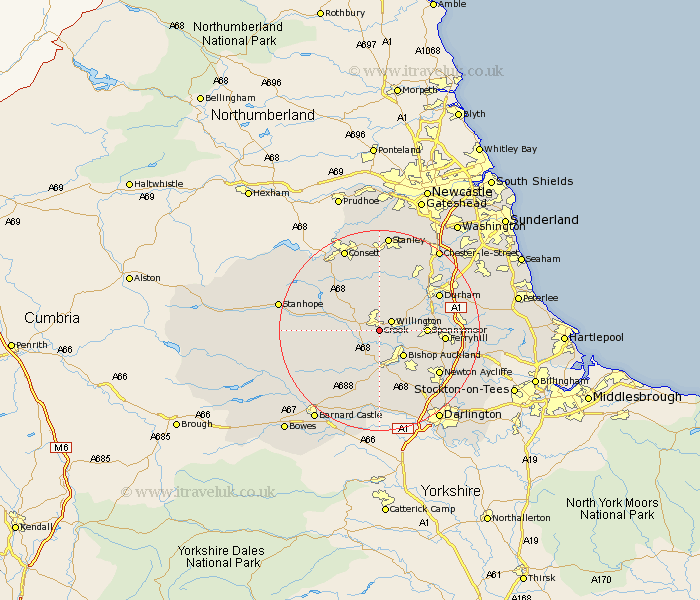
Durham Map Showing Location of Crook
Population: 8121
Area Size (ha): 217
District: Wear Valley
Easting: 417183 Northing: 533930
Latitude: 54.7 Longitude: -1.73
 = Crook
Area Size (ha): 217
District: Wear Valley
Easting: 417183 Northing: 533930
Latitude: 54.7 Longitude: -1.73
= Crook
This Crook map below is supplied by Google. Use the tools in the top left corner to zoom into street level or zoom out for a road map, you may also need to zoom in to see Crook on the map. Click and drag the map to move around. If the map fails to load try and refresh your browser or zoom in or out (+ or -).
Update - it seems Google no longer allow people to use their maps for free! This Crook map sometimes loads and sometimes gives a error. I am working on a solution.
Closest 30 Towns or Cities to Crook (Population over 500)
Willington 2.83km High Etherley 5.66km Etherley 5.66km Tow Law 6.51km Coundon 6.51km Bishop Auckland 7.02km West Auckland 7.42km Spennymoor 8.57km Shildon 9.15km Brandon 9.33km Cornsay 9.51km Esh 9.51km Evenwood 9.51km Wolsingham 9.81km Cockfield 10.21km Ushaw Moor 10.7km Langley Park 11.91km Ferryhill 11.93km Witton Gilbert 12.84km Lanchester 12.98km Durham 13.02km Cornforth 13.92km West Cornforth 13.92km Newton Aycliffe 14.17km Bowburn 14.4km Shincliffe 14.83km Sacriston 14.98km Coxhoe 15.1km Staindrop 15.43km Bishop Middleham 16.17km