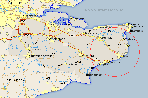
Kent Map Showing Location of Coldred
Population: 1761
District: Dover
Easting: 627185 Northing: 145907
Latitude: 51.17 Longitude: 1.25
 = Coldred
District: Dover
Easting: 627185 Northing: 145907
Latitude: 51.17 Longitude: 1.25
= Coldred
This Coldred map below is supplied by Google. Use the tools in the top left corner to zoom into street level or zoom out for a road map, you may also need to zoom in to see Coldred on the map. Click and drag the map to move around. If the map fails to load try and refresh your browser or zoom in or out (+ or -).
Update - it seems Google no longer allow people to use their maps for free! This Coldred map sometimes loads and sometimes gives a error. I am working on a solution.
Closest 30 Towns or Cities to Coldred (Population over 500)
Lydden 1.86km Shepherdswell 2.18km Sibertswold 2.18km Temple Ewell 2.19km Ewell 2.19km Eythorne 2.97km River 3.89km Alkham 3.89km West Langdon 4.65km Langdon 4.65km Saint Margaret's at Cliffe 5.01km St Margaret at Cliffe 5.01km St. Margaret at Cliffe 5.01km St Margaret's at Cliffe 5.01km Saint Margaret at Cliffe 5.01km St. Margarets 5.01km St. Margaret's at Cliffe 5.01km St Margarets 5.01km Saint Margarets 5.01km Swingfield 5.95km Dover 6.7km Northbourne 8.04km Eastry 8.18km Mongeham 8.94km Great Mongeham 8.94km Staple 9.26km Hawkinge 9.42km Elham 9.48km Folkstone 10.37km Folkestone 10.37km