Buckinghamshire Map Showing Location of Cholesbury
District: Chiltern
Easting: 493182 Northing: 206613
Latitude: 51.75 Longitude: -0.65
 = Cholesbury
Easting: 493182 Northing: 206613
Latitude: 51.75 Longitude: -0.65
= Cholesbury
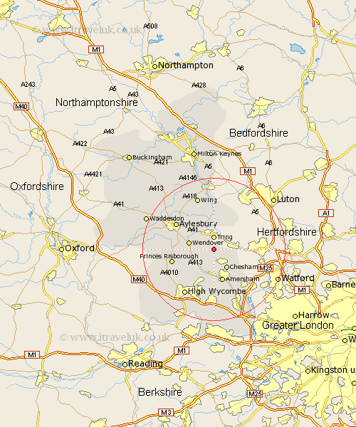
This Cholesbury map below is supplied by Google. Use the tools in the top left corner to zoom into street level or zoom out for a road map, you may also need to zoom in to see Cholesbury on the map. Click and drag the map to move around. If the map fails to load try and refresh your browser or zoom in or out (+ or -).
Update - it seems Google no longer allow people to use their maps for free! This Cholesbury map sometimes loads and sometimes gives a error. I am working on a solution.
Closest 30 Towns or Cities to Cholesbury (Population over 500)
Lee 4.36km Great Missenden 6.54km Chesham 6.54km Halton 6.83km Wendover 7.13km Buckland 7.21km Aston Clinton 7.21km Marsworth 7.5km Pitstone 7.76km Weston Turville 7.81km Prestwood 7.99km Ellesborough 9.18km Cheddington 9.33km Little Missenden 9.33km Ivinghoe 9.54km Amersham 9.54km Stoke Mandeville 9.89km Latimer 10.12km Great Kimble 10.49km Kimble 10.49km Hazlemere 11.64km Edlesborough 12.03km Princes Risborough 12.06km Hughenden 12.52km Aylesbury 12.71km Slapton 13.03km Longwick 13.9km Stone 14.84km Penn 15km Bradenham 15.18km