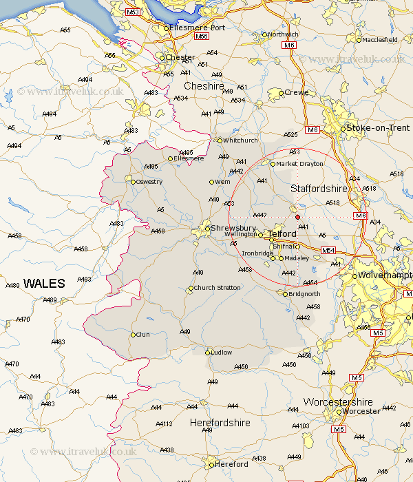
Shropshire Map Showing Location of Chetwynd Aston
Population: 464
Easting: 375253 Northing: 317031
Latitude: 52.75 Longitude: -2.37
 = Chetwynd Aston
Easting: 375253 Northing: 317031
Latitude: 52.75 Longitude: -2.37
= Chetwynd Aston
This Chetwynd Aston map below is supplied by Google. Use the tools in the top left corner to zoom into street level or zoom out for a road map, you may also need to zoom in to see Chetwynd Aston on the map. Click and drag the map to move around. If the map fails to load try and refresh your browser or zoom in or out (+ or -).
Update - it seems Google no longer allow people to use their maps for free! This Chetwynd Aston map sometimes loads and sometimes gives a error. I am working on a solution.
Closest 30 Towns or Cities to Chetwynd Aston (Population over 500)
Woodcote 2.91km Lilleshall 2.91km Edgmond 3.84km Newport 3.87km Chetwynd 4.33km Downington 5.82km Donnington 5.82km Oakengates 7.15km Trench 7.68km Cherrington 9.16km Shifnal 9.26km Ketley 9.62km Hadley 9.62km Telford 10.09km Hinstock 10.83km Dawley 11.45km Wellington 11.53km Cheswardine 13.41km Madeley 13.73km Wrockwardine 14.57km Ironbridge 14.62km Albrighton 14.62km Ercall Magna 15.7km High Ercall 15.7km Stoke upon Tern 15.79km Stoke 15.79km Broughton 16.72km Broseley 16.78km Rodington 16.93km Market Drayton 17.98km